Uploads by Luke.miller
Jump to navigation
Jump to search
This special page shows all uploaded files.
| Date | Name | Thumbnail | Size | Description | Versions |
|---|---|---|---|---|---|
| 09:53, 14 May 2021 | Scenario- alternative futures.jpg (file) | 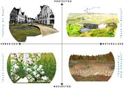 |
1.59 MB | This graphic shows the possible alternative futures of peatlands in an artistic exploration - where extreme cases of Naturalised to Urbanized landscapes and protected to neglected landscapes are explored. | 1 |
| 10:12, 14 May 2021 | DPSIR Framework.jpg (file) | 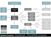 |
108 KB | The DPSIR system Analysis shows the main drivers, pressures, states and impacts that are relevant to the Peatlands. | 1 |
| 10:16, 14 May 2021 | Scenario brainstorming.jpg (file) | 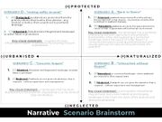 |
178 KB | In this graphic we utilised the Narrative scenario template to brainstorm key points that we wanted to expressive in the graphics of the visualizations | 1 |
| 10:50, 14 May 2021 | Sustainability goals.jpg (file) |  |
123 KB | the UN 17 sustainable development goals | 1 |
| 13:07, 24 May 2021 | FLOOD TIMELINEjpg.jpg (file) | 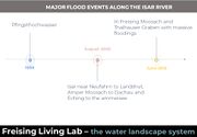 |
86 KB | A timeline of the 3 most recent and significant flood events in the Isar River system | 1 |
| 13:15, 24 May 2021 | Wider water system.jpg (file) | 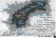 |
1.75 MB | The wider Water System in the Isar River Basin - showing the course of the Isar River, and significant cities and towns where the Isar flows through. The map also shows established floodplains and the position of extreme flood hazard areas. | 1 |
| 14:08, 24 May 2021 | Sylvensteinspeicher-Isar-4943034 1920.jpg (file) | 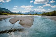 |
782 KB | In this image of the Isar river, the Alps can be seen in the background near Sylvensteinspeicher. | 1 |
| 14:29, 24 May 2021 | Isar River Sylvensteinspeicher.jpg (file) | 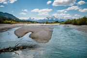 |
782 KB | In this image of the Isar river, the Alps can be seen in the background near Sylvensteinspeicher. | 1 |
| 08:08, 25 May 2021 | Development goals and values.jpg (file) | 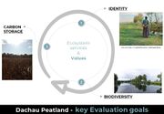 |
113 KB | The values and development goals for our project site are centred around these 3 core values of the Peatland-scape | 1 |
| 14:58, 28 May 2021 | Landuse map vision.jpg (file) | 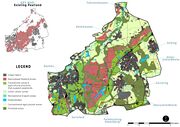 |
1.9 MB | produced on Arcmap and photshop | 1 |
| 14:58, 28 May 2021 | IMPLEMENTATION MAPS.jpg (file) | 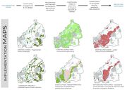 |
1.63 MB | maps produced on armap and photoshop | 1 |
| 15:00, 28 May 2021 | Transect map.jpg (file) | 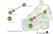 |
1.8 MB | maps produced on armap and photoshop | 1 |
| 15:00, 28 May 2021 | Transect section 1.jpg (file) | 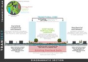 |
1.79 MB | sections made on photoshop | 1 |
| 15:01, 28 May 2021 | Visualizations.jpg (file) | 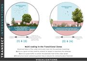 |
1.82 MB | sections made on photoshop | 1 |
| 09:19, 7 June 2021 | FRONTCOVER.jpeg (file) | 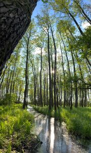 |
412 KB | This image was taken at the Pullinger peatlands location where ecological compensation is implemented | 1 |
| 09:34, 7 June 2021 | FRONTCOVER5.jpeg (file) | 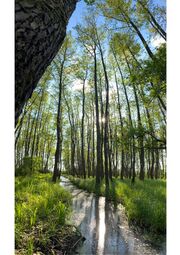 |
1.86 MB | This image was taken at the Pullinger peatlands location where ecological compensation is implemented | 1 |
| 09:38, 7 June 2021 | FRONTCOVER6.jpg (file) |  |
1.72 MB | This image was taken at the Pullinger peatlands location where ecological compensation is implemented | 1 |
| 09:42, 7 June 2021 | FRONTCOVER10.jpg (file) | 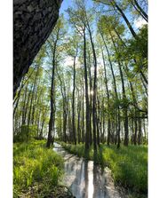 |
1.65 MB | This image was taken at the Pullinger peatlands location where ecological compensation is implemented | 1 |