WAVE Team 1 Freising 2021: Difference between revisions
(Created page with "'''>>>back to working groups overview''' '''>>>basic editing tutorial <div id="BackToTop" class="noprint" styl...") |
|||
| (144 intermediate revisions by 4 users not shown) | |||
| Line 11: | Line 11: | ||
{| align="right" width="400pt" style="background:Gainsboro; color:black" | {| align="right" width="400pt" style="background:Gainsboro; color:black" | ||
|- | |- | ||
| '''Area''' ||style="background:Lavender"| '' | | '''Area''' ||style="background:Lavender"| ''Freising,Bavaria'' | ||
|- | |- | ||
| '''Place''' || style="background:Lavender"|'' | | '''Place''' || style="background:Lavender"|''Pullinger Weiher'' | ||
|- | |- | ||
| '''Country''' || style="background:Lavender"|'' | | '''Country''' || style="background:Lavender"|''Germany'' | ||
|- | |- | ||
| '''Topics''' || style="background:Lavender"|'' | | '''Topics''' || style="background:Lavender"|''return to nature'' | ||
|- | |- | ||
| '''Author(s)''' || style="background:Lavender"|'' | | '''Author(s)''' || style="background:Lavender"|''Mahmoud, Marco, Doraed'' | ||
|- | |- | ||
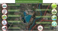
| colspan="3" align="center" style="background:silver"| [[File: | | colspan="3" align="center" style="background:silver"| [[File:pulling_lake_case_study_template.jpg|400px]] | ||
|- | |- | ||
| ||style="background:Lavender"| | | ||style="background:Lavender"| | ||
| Line 29: | Line 29: | ||
= Rationale = | = Rationale = | ||
*'' | *''This artificial lake was created through gravel excavation works. Now it works as recreational spot. The motivation is to bring this lake to nature by improving biodiovesity and livng habitat'' | ||
*''Format: 3-4 sentences'' | *''Format: 3-4 sentences'' | ||
| Line 35: | Line 35: | ||
''You can edit this map with the [[Special:MapEditor|map editor]]'' | ''You can edit this map with the [[Special:MapEditor|map editor]]'' | ||
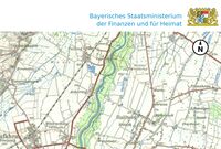
{{#display_map: | {{#display_map: 48.35310028244689,11.710463125074106~study area ~pulling lake | ||
}} | }} | ||
= Water as a natural system = | = Water as a natural system = | ||
== Geomorphology, typologies and dynamics of water areas == | == Geomorphology, typologies and dynamics of water areas == | ||
*''Describe the water areas of your area in the contxt of the wider water system'' | *''Describe the water areas of your area in the contxt of the wider water system | ||
The pulling lake is several artificial lakes in the southern area of the upper bavarian district. the bonds are on the both sides of Pulling – Achering road. The water surface of the larger southern lake is 24 hectares, and the smaller lake 6.3 hectares.'' | |||
*''How does water appear in the landscape of your living lab? What types of water areas are common? | *''How does water appear in the landscape of your living lab? What types of water areas are common? | ||
The source of the water is the underground water and the 4 lakes were created through many years of gravel mining. The two eastern lakes were taken over by the recreation area association and converted into bathing lakes. Sunbathing areas, parking spaces and a kiosk were created on the north and south bank | |||
*''Please identify the water bodies' catchment areas, tributaries and floodplains | *''Please identify the water bodies' catchment areas, tributaries and floodplains | ||
*''Which dynamics do these water areas have?'' | pulling ponds were created through gravel mining and therefore have no above-ground inflows or outflows | ||
*''Which dynamics do these water areas have?'' | |||
Actually, The status of water ponds is some how static because they does not have any flows. But the surrounded shore have some dynamic activities. There is a big gravel processing factory in the north ,,,, it was established at 1954 where sands and gravels containing quartz are extracted or processed there. The two eastern lakes were taken over by the recreation area association and converted into bathing lakes. Sunbathing areas, parking spaces and a kiosk were created on the north and south banks. Only so limited number of services, just one restaurant and one car parking places in the north. | |||
*''Have there been any flood events in the past?'' | *''Have there been any flood events in the past?'' | ||
No flooding occurred before in Pulling Lakes because the water source is groundwater. But due to the close proximity of the lakes to the River Isar, it is possible that this region was affected by the historical floods of the Isar. In 1813, during the annual flooding cities along the Isar were flooded again and again, causing severe damage and even killing people along the river banks. | |||
<gallery caption=" " widths="200px" heights="150px" perrow="5"> | <gallery caption=" " widths="200px" heights="150px" perrow="5"> | ||
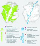
File: | File:Green_Blue_Driver.jpg|''add a caption'' | ||
File: | [[Green_Blue_Driver.jpg|thumb]] | ||
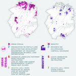
File: | File:Urban_Sprawl_Driver.jpg|''add a caption'' | ||
[[Urban_Sprawl_Driver.jpg|thumb]] | |||
File:Airport_Driver.jpg|''add a caption'' | |||
[[Airport_Driver.jpgg|thumb]] | |||
File:Responses.jpg|''add a caption'' | |||
[[Responses.jpg|thumb]] | |||
</gallery> | </gallery> | ||
== Water as a living space == | == Water as a living space == | ||
*''Which habitats can be found in and along the water areas of your area?'' | *''Which habitats can be found in and along the water areas of your area?'' | ||
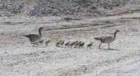
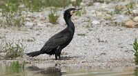
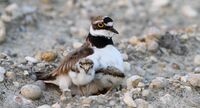
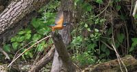
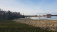
During our site visits we just noticed a few number of ducks, singing birds and soil insects but we did not notice fishes even in lakes where they stopped the excavation work there | |||
*''How is the water quality in your water areas?'' | *''How is the water quality in your water areas?'' | ||
Excavations have been stopped in the two western lakes and that is why the quality of water is better than the two eastern lakes. These artificial lakes provide many ecosystem services to humans. These include provisioning services, such as fish yield, as well as a range of cultural services, such as recreation | |||
*''Which areas are still natural, which are urbanised/artificial?'' | *''Which areas are still natural, which are urbanised/artificial?'' | ||
The whole site is artificial, starting from the industrial activity (gravel mining) reaching to the surrounded intensive agriculture land . Although the benefits of water-based recreation can be substantial, water-based activities have also negatively impact the biodiversity of freshwater ecosystems. For example, human activities can reduce littoral and riparian habitat quality and thereby negatively affect associated taxa . Water-based recreation has also been found to negatively impact birds through fright responses to humans , dogs or pleasure boats . Therefore, the management of gravel pit lakes and other artificial water bodies would benefit from the joint consideration of the well-being aquatic recreation generates for humans and the possible negative biodiversity impacts from aquatic recreation. | |||
*''Are the rivers permeable for fish or blocked by artificial elements?(approx 200 signs)'' | *''Are the rivers permeable for fish or blocked by artificial elements?(approx 200 signs)'' | ||
*''add 1-2 graphical representations to the image gallery, you can add more if you like'' | *''add 1-2 graphical representations to the image gallery, you can add more if you like'' | ||
<gallery caption=" " widths="200px" heights="150px" perrow="5"> | <gallery caption=" " widths="200px" heights="150px" perrow="5"> | ||
File: | File:Ducks.jpg|''Ducks'' | ||
File: | File:Grey_Geese.jpg|''Grey_Geese'' | ||
File: | File:Pigeons.jpg|''Pigeons'' | ||
File:Singing_birds.jpg|''Singing_birds'' | |||
</gallery> | </gallery> | ||
[[File:Risks-and-potentials.jpg|thumb]] | |||
[[File:Socioeconomic-and-natural-elements.jpg|thumb]] | |||
== Blue and Green Infrastructure == | == Blue and Green Infrastructure == | ||
| Line 73: | Line 87: | ||
<gallery caption=" " widths="200px" heights="150px" perrow="5"> | <gallery caption=" " widths="200px" heights="150px" perrow="5"> | ||
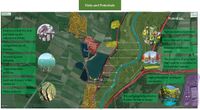
File: | File:Risks-and-potentials.jpg|''main risks and potentials for water landscape'' | ||
File: | File:socioeconomic-and-natural-elements.jpg|''socio-economic and natural elements of study area'' | ||
</gallery> | </gallery> | ||
= Water as a cultural space = | = Water as a cultural space = | ||
[[thumb]] | |||
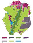
[[File:Land-use-map.jpg|thumb]] | |||
== Land use and water== | == Land use and water== | ||
*''map the land uses along your water areas: settlements, infrastructure, agriculture, resource extraction, natural areas, energy production...'' | *''map the land uses along your water areas: settlements, infrastructure, agriculture, resource extraction, natural areas, energy production...'' | ||
*''describe in particular the historical evolution of land use pattern, please make use of historical maps'' | *''describe in particular the historical evolution of land use pattern, please make use of historical maps' | ||
'''The land use was basically a grassland and then the excavation work started after that the underground water appeared then shaped the current water landscape''' ' | |||
*''description evolution, status quo and driving forces, is the land use likely to change? Why is that? (approx 200 signs)'' | *''description evolution, status quo and driving forces, is the land use likely to change? Why is that? (approx 200 signs)'' | ||
''In the areas with the excavation work, yes, and it will be a series of lakes and in the current lakes more activities and cultural elements could be added to enhance the land use'''' | |||
*''add 1-2 graphical representations to the image gallery, you can add more if you like'' | *''add 1-2 graphical representations to the image gallery, you can add more if you like'' | ||
<gallery caption=" " widths="200px" heights="150px" perrow="5"> | <gallery caption=" " widths="200px" heights="150px" perrow="5"> | ||
File: | File:land-use-map.jpg|''add a caption'' | ||
File: | [[File:Land-use-map.jpg|thumb]] | ||
File: | File:Historical-map-1.jpg.jpg | ||
[[File:Historical-map-1.jpg.jpg|thumb]]|''add a caption'' | |||
File:Historical-map-2.jpg.jpeg|''add a caption'' | |||
[[File:Historical-map-2.jpg.jpeg|thumb]] | |||
</gallery> | </gallery> | ||
== Cultural and spatial typologies of water areas == | == Cultural and spatial typologies of water areas == | ||
*''Which spatial patterns have evolved in relation to your water areas?'' | *''Which spatial patterns have evolved in relation to your water areas?''''It developed through the excavation work flow from an industrial site to a water landscape which consists of several lakes separated by paths, and a restaurant and some recreational facilities were then added so the place at the moment is considered as a recreational destination.''' ' | ||
*''What is the role of water areas within the overall urban morphology?'' (approx 200 signs)'' | *''What is the role of water areas within the overall urban morphology?''''Pullinger Weiher is considered as one of the most attractive recreational areas in Freising and it has good potential to be more attractive'''' (approx 200 signs)'' | ||
*''add 1-2 graphical representations to the image gallery, you can add more if you like'' | *''add 1-2 graphical representations to the image gallery, you can add more if you like'' | ||
<gallery caption=" " widths="200px" heights="150px" perrow="5"> | <gallery caption=" " widths="200px" heights="150px" perrow="5"> | ||
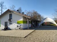
File: | File:Recreational-facilities.jpg.jpeg|''add a caption'' | ||
File: | [[File:Recreational-facilities.jpg.jpeg|thumb]] | ||
File: | File:Recreational-facilities-1.jpg.jpeg|''add a caption'' | ||
[[File:Recreational-facilities-1.jpg.jpeg|thumb]] | |||
File:Source_of_water.jpg|''The source of the water is the underground water and the 4 lakes were created through many years of gravel mining'' | |||
</gallery> | </gallery> | ||
== Sacred spaces and heritage == | == Sacred spaces and heritage == | ||
*''Which places/elements hold cultural value and to whom?'' | *''Which places/elements hold cultural value and to whom? ''''At the moment there is no cultural value for the area but there is a big potential to add more cultural elements and activities to enhance or the add a cultural value to this territory'''' | ||
* ''You may add a map and some images, please also explain in your caption why these elements are valuable'' | * ''You may add a map and some images, please also explain in your caption why these elements are valuable'' | ||
<gallery caption=" " widths="200px" heights="150px" perrow="5"> | <gallery caption=" " widths="200px" heights="150px" perrow="5"> | ||
</gallery> | </gallery> | ||
== Visual appearance and landscape narrative == | == Visual appearance and landscape narrative == | ||
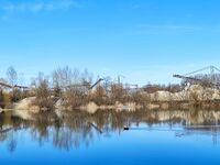
*''Which elements are essential for the landscape character?'' | *''Which elements are essential for the landscape character?''''The excavation factory in the background is essential, it is not an attractive point to focus on but it is the base of the whole landscape, the big open lakes with the surrounding grass lands add a good composition of blue and green infrastructure and together they make an essential image for the landscape'''' | ||
*''Has the landscape been painted or otherwise depicted, when and whom? Which elements are essential?'' | *''Has the landscape been painted or otherwise depicted, when and whom? Which elements are essential?''''Unfortunately,No'''' | ||
*''Which narratives exist? Who has written about this landscape or depicted it in some way?'' | *''Which narratives exist? Who has written about this landscape or depicted it in some way?''''No narratives at the moment but hopefully in future with the new added cultural elements some narratives could be written'''' | ||
*''You can add text and images'' | *''You can add text and images'' | ||
<gallery caption=" " widths="200px" heights="150px" perrow="5"> | <gallery caption=" " widths="200px" heights="150px" perrow="5"> | ||
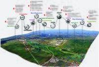
File: | File:Excavation_Site_Background.jpg|''The excavation factory is clearly appearing in the background'' | ||
File: | [[File:Excavation_Site_Background.jpg|thumb]] | ||
</gallery> | </gallery> | ||
= Water and People = | = Water and People = | ||
[[File:Accessibility map case study template.jpg|thumb]] | |||
== Accessibility and usability == | == Accessibility and usability == | ||
*''Where are your water areas accessible, and where not? How strong are spatial obstacles preventing access?'' | *''Where are your water areas accessible, and where not? How strong are spatial obstacles preventing access?'' | ||
| Line 131: | Line 149: | ||
<gallery caption=" " widths="500px" heights="200px" perrow="5"> | <gallery caption=" " widths="500px" heights="200px" perrow="5"> | ||
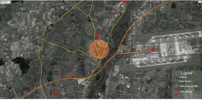
File: | File:accessibility_map_case_study_template.jpg|''main connections with surrounding communities'' | ||
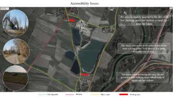
File: | File:Accessibility-issues.jpg.png|''accessibility map'' | ||
[[File:Accessibility-issues.jpg.png|thumb]] | |||
</gallery> | </gallery> | ||
| Line 145: | Line 166: | ||
<gallery caption=" " widths="500px" heights="200px" perrow="5"> | <gallery caption=" " widths="500px" heights="200px" perrow="5"> | ||
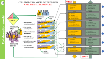
File: | File:Collaboration-model.png|''Carl Steinitz Collaboration Framework'' | ||
File: | [[File:Collaboration-model.png|thumb]] | ||
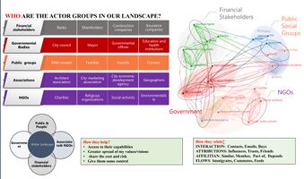
File: | File:Actors_groups.jpg|''Actors groups diagram and relations between them'' | ||
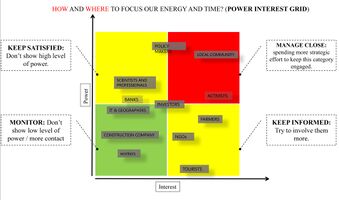
File:Power_interest_grid.jpg|''Power interest grid'' | |||
[[File:Stackholders.jpg.png|thumb]] | |||
</gallery> | </gallery> | ||
| Line 159: | Line 182: | ||
<gallery caption=" " widths="500px" heights="200px" perrow="5"> | <gallery caption=" " widths="500px" heights="200px" perrow="5"> | ||
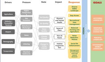
File: | File:DPSIR.jpg.jpeg|''DPSIR analysis'' | ||
File: | [[File:DPSIR.jpg.jpeg|thumb]] | ||
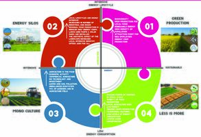
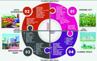
File: | File:Scenario_Matrix_1.jpg|''Scenario matrix for two drivers of Agriculture and energy'' | ||
File:Scenario_Matrix_2.jpg|''Scenario matrix for two drivers of Industry and urban sprawl'' | |||
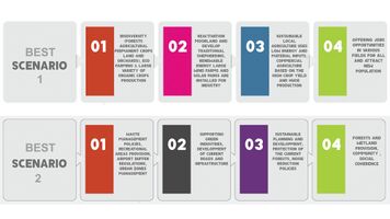
File:Best_Scenarios.jpg|''Best two scenarios from the two previous matrices'' | |||
</gallery> | </gallery> | ||
| Line 168: | Line 193: | ||
*''Ideally, involve the community of your living labs into this process | *''Ideally, involve the community of your living labs into this process | ||
*''Link back to your original targets from section one and the [http://www.un.org/sustainabledevelopment/sustainable-development-goals/Sustainable Development Goals]'' | *''Link back to your original targets from section one and the [http://www.un.org/sustainabledevelopment/sustainable-development-goals/Sustainable Development Goals]'' | ||
* '' | File:Collaboration_stakeholders.png|''Carl Steinitz Collaboration stakeholders'' | ||
[[File:Collaboration stakeholders.png|thumb]] | |||
* '''''The design Strategies:''' | |||
- Preserving Ecological landscape. | |||
- Promoting the recreational area's quality. | |||
- Enhancing the quality of ecosystems. | |||
- Adding a cultural identity to the territory | |||
- Involving the community in the design process. | |||
- Better accessibility for pedestrian and bikes'' | |||
= Spatial Strategy and Transect = | = Spatial Strategy and Transect = | ||
*''translate your strategic goals into a vision'' | *''translate your strategic goals into a vision'' | ||
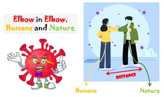
- The vision '''( Elbow in Elbow Humans and Nature)''' is inspired from the Covid-19 hygienic regulations which aims at keeping people safe and at the same time giving the possibility to meet and be in touch with one another so the vision is to be in touch with nature but to keep enough distance and consider the protected areas' regulation so that the Biodiversity can find its own way to flourish and finally make a positive influence on nature as well as humans . | |||
*''develop a spatial translation of your vision'' | *''develop a spatial translation of your vision'' | ||
- The main idea in our concept is the transect landscape and how people can go through landscape from urban to more natural space. | |||
- Green transition park like (community gardens) south of Freising along the ring road which is now under construction to work as a recreational and interacting zone for people to landscape and also to limit the urban sprawl in that direction. | |||
- Directing urban growth away from noise and air pollution by planning for new services and industries as the following directions: | |||
1- For Freising towards the East and West & For Pulling towards west | |||
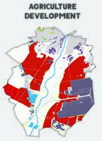
- Reducing the intensive agriculture and protecting the biodiversity in these area by applying the following strategies: | |||
1- Variation in crop yields (permanent and annual crops) besides improving pastures. | |||
2- Planting local flowers, fruit and vegetables. | |||
3- protection natural habitats. | |||
4- Support farmers by applying plant science, eco farming concepts & biotechnology. | |||
5- Regulations to reduce using fertilizers to protect soil. | |||
- Green buffer zone to protect water channels & agriculture land from land erosion | |||
- Protecting the birds from aircraft accidences (40 protected bird species in the bird sanctuary area ) by applying these two methods (using tall grass and modifying the soil structure by adding stony material to the surface structure of land) that make the soil less attractive habitat for small insects which attract by the way birds for feeding | |||
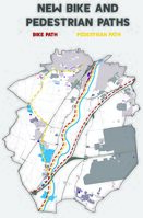
- New bike paths for easy access : | |||
1- New path west the Isar forests along the road from Freising to Munich | |||
2- New path along Moosach From Feising to Pulling. | |||
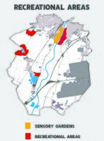
- Recreational area with different activities such as camping , barbeque facility, outdoor exercise along the Moosach away from noise pollution and near to people in Freising besides birds watching near to Pulling (Bird protection area) | |||
- Preserve and improve the wetland which are Isar forests as it is the nearest natural area to pulling lakes | |||
*''exemplify your vision in the form of a transect with concrete interventions'' | *''exemplify your vision in the form of a transect with concrete interventions'' | ||
At first near the urban zone we suggest to provide community gardens to be as an edge for the city and limit the urban sprawl in that direction. | |||
- here people can share their plants and producing fruit, vegetables or pant some flowers for their attractive appearance. | |||
- Not only to stop the urban sprawl but also community gardens can fulfill a variety of purposes such as aesthetic and community improvement, physical or mental well-being, or land conservation.Then people can move from community gardens to mix agriculture land where we suggest to apply Eco farming principles. we can define this area as "an integrated farming system that achieves for sustainability, the enhancement of soil fertility and biodiversity and for sure that will reflect directly on the underground water quality which create our ponds near to these agriculture land. | |||
After that in the transition zone we also added some new access to the natural areas by adding new bike lanes along the existing roads to achieve the goal of accessible landscape and offer several ways for people to reach that natural place. | |||
the last part in that transition zone is the recreational area. We suggest to locate these areas close to the natural zone where people can go and enjoy the green and blue infrastructure with more options for swimming, relaxing, playing or even having their lunch in restaurants and new services which we will provide there. After that people can reach their destination from urban landscape to green and blue natural scene where is our pulling lakes. we suggest to apply the idea of floating islands to transform these artificial lakes to be more natural with large number of habitat and fishes and for sure that will reflect on the identity of the space itself by enhancing the character of these lakes not only artificial ponds for gravel excavation but also suitable place for habitats. | |||
*''add map(s) and visualizations'' | *''add map(s) and visualizations'' | ||
<gallery caption=" " widths="500px" heights="200px" perrow="1"> | <gallery caption=" " widths="500px" heights="200px" perrow="1"> | ||
File: | File:Our_vision.jpg|''Our vision is "Elbow in elbow humans and nature'' | ||
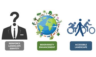
File: | File:Our_Goals.jpg|''We have three main goals which are " REINFORCE LANDSCAPE IDENTITY & BIODIVERSITY ENHANCEMENT & ACCESSIBLE LANDSCAPE"'' | ||
File: | File:Accessibility_Facilities.jpg|''connecting the existing bike paths and creating a network of bike paths.'' | ||
File: | [[Accessibility_Facilities.jpg|thumb]] | ||
File:Recreational_Areas...jpg|''accessible Sensory gardens and Recreational areas.'' | |||
[[Recreational_Areas...jpg|thumb]] | |||
File:Agriculture_Development.jpg|''Applying eco-farming concepts to the intensive agricultural areas.'' | |||
[[Recreational_Areas.jpg|thumb]] | |||
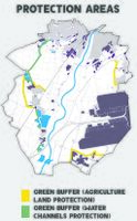
File:Protection_Areas...jpg|''Green buffer zone around the water channels.'' | |||
[[Protection_Areas...jpg|thumb]] | |||
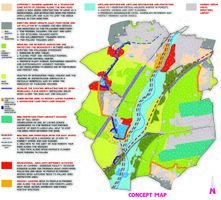
File:Final_scenario...jpg|''The final scenario shows the implementation of all the suggested spatial strategies.'' | |||
[[Final_scenario...jpg|thumb]] | |||
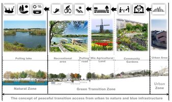
File:Transect Concept.jpg|''Transition section to clarify how the people could move from the urban landscape toward the more natural landscape by offering a sustainable transition zone in between.'' | |||
</gallery> | </gallery> | ||
| Line 190: | Line 256: | ||
<gallery caption=" " widths="500px" heights="200px" perrow="1"> | <gallery caption=" " widths="500px" heights="200px" perrow="1"> | ||
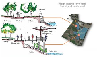
File: | File:Lake_edge_section.jpg|''we suggest some single points along the road of pulling city where people can stop their cars and have a 360 degree view for the lakes with it’s shores. In that place the road is lifted up by 3 meters above the lake water level so we suggest these balconies for passengers but not along the whole road, it is just in two or three single points as it shows on map.'' | ||
File: | [[Design_Sketchs.jpg|thumb]] | ||
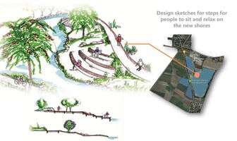
File:Shore_steps.jpg|''In the place shown on the map, we have new shore in between lakes is being constructed. We suggest to design some steps for people can meet and make some parties or play and we add some trees to enhance the identity for the space more.'' | |||
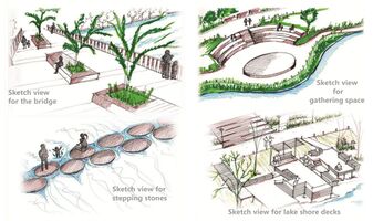
File:Designs proposales for connectivity.jpg|''Here we tried to elaborate our design ideas more and more to be suitable place for different activities for people. We suggest to use natural materials for constructing these steps and zones. We also have some ideas to link the different lakes and shores by these simple wooden bridges. And in some specific parts of the lakes where the water depth is shallow, we suggest to provide these stones steps for people to be more in contact with the nature there.'' | |||
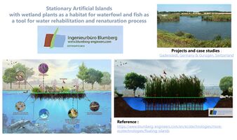
File:Renaturation Concept.jpg|''As we presented in the beginning that we have two main goals which are social and nature. The social goal is achieved by adding these recreational zones and for the natural one we searched for how to transform the artificial lakes to be more natural and we found that method is so close to our case. This method is called Artificial floating Islands in the middle of the lakes where wetland plants are growing as a habitat for waterfowl and fish as a tool for water rehabilitation and naturalization process.This method will be applied only on in the western lakes where the excavation work was stopped to avoid any conflicts with the excavation work.This method is published by the (Ingenieur buro Bloomberg) and they applied this Artificial Floating Islands in two projects in Germany and Switzerland'' | |||
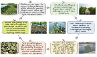
File:Renaturation_Process.jpg|''Artificial floating islands are consisting of floating dense mats of roots of marsh plants. Used for nesting and refuge area for waterfowl and wastewater treatment by submerged biofilms. In point number 4 we have some Plants genera which will help in absorbing harmful nutrients like phosphorus and nitrogen from water ponds. Microbes in the plant roots growing in the water are improving water quality. Floating root mats prevent the growing of algae. They help also in providing wildlife habitats for waterfowl above the water surface. It also considered breeding areas for young fishes in the root network below.'' | |||
</gallery> | </gallery> | ||
== References == | == References == | ||
* ''give a full list of the references you have used for your case'' | * ''give a full list of the references you have used for your case'' | ||
https://www.kronthalerkies.de/renaturierung-rekultivierung/ | |||
https://geoportal.bayern.de/bayernatlas/?lang=de&topic=ba&bgLayer=atkis&catalogNodes=11,122 | |||
https://de.wikipedia.org/wiki/Pullinger_Weiher | |||
https://www.blumberg-engineers.com/en/ecotechnologies/more-ecotechnologies/floating-islands | |||
= Process Reflection = | = Process Reflection = | ||
| Line 204: | Line 278: | ||
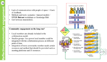
*''What would you do differently next time?'' | *''What would you do differently next time?'' | ||
*''You can also use diagrams/visuals'' | *''You can also use diagrams/visuals'' | ||
<gallery caption=" " widths="500px" heights="200px" perrow="5"> | |||
File:Refrections.png|''Reflections'' | |||
[[File:Refrections.png|thumb]] | |||
</gallery> | |||
---- | ---- | ||
[[Category:WAVE Case Study 2021]] | [[Category:WAVE Case Study 2021]] | ||
[[Category:WAVE Case Study]] | [[Category:WAVE Case Study]] | ||
Latest revision as of 08:16, 3 June 2021
>>>back to working groups overview
| Area | Freising,Bavaria | |
| Place | Pullinger Weiher | |
| Country | Germany | |
| Topics | return to nature | |
| Author(s) | Mahmoud, Marco, Doraed | |

| ||
Rationale
- This artificial lake was created through gravel excavation works. Now it works as recreational spot. The motivation is to bring this lake to nature by improving biodiovesity and livng habitat
- Format: 3-4 sentences
Location and scope
You can edit this map with the map editor
Water as a natural system
Geomorphology, typologies and dynamics of water areas
- Describe the water areas of your area in the contxt of the wider water system
The pulling lake is several artificial lakes in the southern area of the upper bavarian district. the bonds are on the both sides of Pulling – Achering road. The water surface of the larger southern lake is 24 hectares, and the smaller lake 6.3 hectares.
- How does water appear in the landscape of your living lab? What types of water areas are common?
The source of the water is the underground water and the 4 lakes were created through many years of gravel mining. The two eastern lakes were taken over by the recreation area association and converted into bathing lakes. Sunbathing areas, parking spaces and a kiosk were created on the north and south bank
- Please identify the water bodies' catchment areas, tributaries and floodplains
pulling ponds were created through gravel mining and therefore have no above-ground inflows or outflows
- Which dynamics do these water areas have?
Actually, The status of water ponds is some how static because they does not have any flows. But the surrounded shore have some dynamic activities. There is a big gravel processing factory in the north ,,,, it was established at 1954 where sands and gravels containing quartz are extracted or processed there. The two eastern lakes were taken over by the recreation area association and converted into bathing lakes. Sunbathing areas, parking spaces and a kiosk were created on the north and south banks. Only so limited number of services, just one restaurant and one car parking places in the north.
- Have there been any flood events in the past?
No flooding occurred before in Pulling Lakes because the water source is groundwater. But due to the close proximity of the lakes to the River Isar, it is possible that this region was affected by the historical floods of the Isar. In 1813, during the annual flooding cities along the Isar were flooded again and again, causing severe damage and even killing people along the river banks.
Water as a living space
- Which habitats can be found in and along the water areas of your area?
During our site visits we just noticed a few number of ducks, singing birds and soil insects but we did not notice fishes even in lakes where they stopped the excavation work there
- How is the water quality in your water areas?
Excavations have been stopped in the two western lakes and that is why the quality of water is better than the two eastern lakes. These artificial lakes provide many ecosystem services to humans. These include provisioning services, such as fish yield, as well as a range of cultural services, such as recreation
- Which areas are still natural, which are urbanised/artificial?
The whole site is artificial, starting from the industrial activity (gravel mining) reaching to the surrounded intensive agriculture land . Although the benefits of water-based recreation can be substantial, water-based activities have also negatively impact the biodiversity of freshwater ecosystems. For example, human activities can reduce littoral and riparian habitat quality and thereby negatively affect associated taxa . Water-based recreation has also been found to negatively impact birds through fright responses to humans , dogs or pleasure boats . Therefore, the management of gravel pit lakes and other artificial water bodies would benefit from the joint consideration of the well-being aquatic recreation generates for humans and the possible negative biodiversity impacts from aquatic recreation.
- Are the rivers permeable for fish or blocked by artificial elements?(approx 200 signs)
- add 1-2 graphical representations to the image gallery, you can add more if you like
Blue and Green Infrastructure
- What are the major potential elements of a green/blue infrastructure network? Are these likely to change/disappear? Why is that?
- You find my background material on green infrastructure in our reading list
- add 1-2 graphical representations to the image gallery, you can add more if you like
Water as a cultural space
Land use and water
- map the land uses along your water areas: settlements, infrastructure, agriculture, resource extraction, natural areas, energy production...
- describe in particular the historical evolution of land use pattern, please make use of historical maps'
The land use was basically a grassland and then the excavation work started after that the underground water appeared then shaped the current water landscape '
- description evolution, status quo and driving forces, is the land use likely to change? Why is that? (approx 200 signs)
In the areas with the excavation work, yes, and it will be a series of lakes and in the current lakes more activities and cultural elements could be added to enhance the land use''
- add 1-2 graphical representations to the image gallery, you can add more if you like
Cultural and spatial typologies of water areas
- Which spatial patterns have evolved in relation to your water areas?'It developed through the excavation work flow from an industrial site to a water landscape which consists of several lakes separated by paths, and a restaurant and some recreational facilities were then added so the place at the moment is considered as a recreational destination. '
- What is the role of water areas within the overall urban morphology?'Pullinger Weiher is considered as one of the most attractive recreational areas in Freising and it has good potential to be more attractive' (approx 200 signs)
- add 1-2 graphical representations to the image gallery, you can add more if you like
Sacred spaces and heritage
- Which places/elements hold cultural value and to whom? 'At the moment there is no cultural value for the area but there is a big potential to add more cultural elements and activities to enhance or the add a cultural value to this territory'
- You may add a map and some images, please also explain in your caption why these elements are valuable
Visual appearance and landscape narrative
- Which elements are essential for the landscape character?'The excavation factory in the background is essential, it is not an attractive point to focus on but it is the base of the whole landscape, the big open lakes with the surrounding grass lands add a good composition of blue and green infrastructure and together they make an essential image for the landscape'
- Has the landscape been painted or otherwise depicted, when and whom? Which elements are essential?'Unfortunately,No'
- Which narratives exist? Who has written about this landscape or depicted it in some way?'No narratives at the moment but hopefully in future with the new added cultural elements some narratives could be written'
- You can add text and images
Water and People
Accessibility and usability
- Where are your water areas accessible, and where not? How strong are spatial obstacles preventing access?
- Who is using the spaces and how?
Community Mapping
What is to be mapped here?
- Social groups from within the community, for example the youth, kids, students, parents, the retired etc. Typically, these groups have specific needs, which you can also make explicit on the map. These people might not be organized in any way, but they are usually present in the context you are observing
- Local stakeholder groups: these groups are organized in one or the other way. They only exist within the community context you are observing. For example: the local community center, local churches, local interest groups, the landowners, small businesses and retailers
- External stakeholder groups are not necessarily present in the environment you are observing, but they may have strong stakes and interests. These can be local authorities, politicians, associations, care services etc.
- For each group, you may identify their needs, objectives, power and capacities
- You may also identify gaps and power conflicts
- Please try to redepict these elements in an integrated way and in relation to your water landscape. What is the relationship between these groups? Are they close or distanced from each other? Who is more powerful? Which voices are hardly heard? Do they have any shared concerns?
Possible Futures
- You can summarize your findings with a SWOT diagram and a DPSI(R) Model
- Link back to the Sustainable Development Goals: Which goals are at risk?
- What is your worst case scenario for this landscape?
- What is your best case scenario for this landscape?
- Present your scenarios in the form of a collage or sketch
- Add text and visuals
Collaborative Goal Setting
- Define strategic planning objectives based on the evaluation findings from your analysis
- Ideally, involve the community of your living labs into this process
- Link back to your original targets from section one and the Development Goals
File:Collaboration_stakeholders.png|Carl Steinitz Collaboration stakeholders
- The design Strategies:
- Preserving Ecological landscape. - Promoting the recreational area's quality. - Enhancing the quality of ecosystems. - Adding a cultural identity to the territory - Involving the community in the design process. - Better accessibility for pedestrian and bikes
Spatial Strategy and Transect
- translate your strategic goals into a vision
- The vision ( Elbow in Elbow Humans and Nature) is inspired from the Covid-19 hygienic regulations which aims at keeping people safe and at the same time giving the possibility to meet and be in touch with one another so the vision is to be in touch with nature but to keep enough distance and consider the protected areas' regulation so that the Biodiversity can find its own way to flourish and finally make a positive influence on nature as well as humans .
- develop a spatial translation of your vision
- The main idea in our concept is the transect landscape and how people can go through landscape from urban to more natural space. - Green transition park like (community gardens) south of Freising along the ring road which is now under construction to work as a recreational and interacting zone for people to landscape and also to limit the urban sprawl in that direction. - Directing urban growth away from noise and air pollution by planning for new services and industries as the following directions: 1- For Freising towards the East and West & For Pulling towards west - Reducing the intensive agriculture and protecting the biodiversity in these area by applying the following strategies: 1- Variation in crop yields (permanent and annual crops) besides improving pastures. 2- Planting local flowers, fruit and vegetables. 3- protection natural habitats. 4- Support farmers by applying plant science, eco farming concepts & biotechnology. 5- Regulations to reduce using fertilizers to protect soil. - Green buffer zone to protect water channels & agriculture land from land erosion - Protecting the birds from aircraft accidences (40 protected bird species in the bird sanctuary area ) by applying these two methods (using tall grass and modifying the soil structure by adding stony material to the surface structure of land) that make the soil less attractive habitat for small insects which attract by the way birds for feeding - New bike paths for easy access : 1- New path west the Isar forests along the road from Freising to Munich 2- New path along Moosach From Feising to Pulling. - Recreational area with different activities such as camping , barbeque facility, outdoor exercise along the Moosach away from noise pollution and near to people in Freising besides birds watching near to Pulling (Bird protection area) - Preserve and improve the wetland which are Isar forests as it is the nearest natural area to pulling lakes
- exemplify your vision in the form of a transect with concrete interventions
At first near the urban zone we suggest to provide community gardens to be as an edge for the city and limit the urban sprawl in that direction. - here people can share their plants and producing fruit, vegetables or pant some flowers for their attractive appearance. - Not only to stop the urban sprawl but also community gardens can fulfill a variety of purposes such as aesthetic and community improvement, physical or mental well-being, or land conservation.Then people can move from community gardens to mix agriculture land where we suggest to apply Eco farming principles. we can define this area as "an integrated farming system that achieves for sustainability, the enhancement of soil fertility and biodiversity and for sure that will reflect directly on the underground water quality which create our ponds near to these agriculture land. After that in the transition zone we also added some new access to the natural areas by adding new bike lanes along the existing roads to achieve the goal of accessible landscape and offer several ways for people to reach that natural place. the last part in that transition zone is the recreational area. We suggest to locate these areas close to the natural zone where people can go and enjoy the green and blue infrastructure with more options for swimming, relaxing, playing or even having their lunch in restaurants and new services which we will provide there. After that people can reach their destination from urban landscape to green and blue natural scene where is our pulling lakes. we suggest to apply the idea of floating islands to transform these artificial lakes to be more natural with large number of habitat and fishes and for sure that will reflect on the identity of the space itself by enhancing the character of these lakes not only artificial ponds for gravel excavation but also suitable place for habitats.
- add map(s) and visualizations
From Theory of Change to Implementation
- For implementing your vision: Which partnerships are needed? Which governance model is required?
- Who needs to act and how? Draw and explain a change/process model/timeline
- Which resources are needed? On which assets can you build?
- add 150 words text and visuals
we suggest some single points along the road of pulling city where people can stop their cars and have a 360 degree view for the lakes with it’s shores. In that place the road is lifted up by 3 meters above the lake water level so we suggest these balconies for passengers but not along the whole road, it is just in two or three single points as it shows on map.
Here we tried to elaborate our design ideas more and more to be suitable place for different activities for people. We suggest to use natural materials for constructing these steps and zones. We also have some ideas to link the different lakes and shores by these simple wooden bridges. And in some specific parts of the lakes where the water depth is shallow, we suggest to provide these stones steps for people to be more in contact with the nature there.
As we presented in the beginning that we have two main goals which are social and nature. The social goal is achieved by adding these recreational zones and for the natural one we searched for how to transform the artificial lakes to be more natural and we found that method is so close to our case. This method is called Artificial floating Islands in the middle of the lakes where wetland plants are growing as a habitat for waterfowl and fish as a tool for water rehabilitation and naturalization process.This method will be applied only on in the western lakes where the excavation work was stopped to avoid any conflicts with the excavation work.This method is published by the (Ingenieur buro Bloomberg) and they applied this Artificial Floating Islands in two projects in Germany and Switzerland
Artificial floating islands are consisting of floating dense mats of roots of marsh plants. Used for nesting and refuge area for waterfowl and wastewater treatment by submerged biofilms. In point number 4 we have some Plants genera which will help in absorbing harmful nutrients like phosphorus and nitrogen from water ponds. Microbes in the plant roots growing in the water are improving water quality. Floating root mats prevent the growing of algae. They help also in providing wildlife habitats for waterfowl above the water surface. It also considered breeding areas for young fishes in the root network below.
References
- give a full list of the references you have used for your case
https://www.kronthalerkies.de/renaturierung-rekultivierung/ https://geoportal.bayern.de/bayernatlas/?lang=de&topic=ba&bgLayer=atkis&catalogNodes=11,122 https://de.wikipedia.org/wiki/Pullinger_Weiher https://www.blumberg-engineers.com/en/ecotechnologies/more-ecotechnologies/floating-islands
Process Reflection
- Reflect in your intercultural and interdisciplinary team on the outcomes of your study
- Which limitations were you facing?
- What have you learnt from each other?
- What did you learn in the Living Labs?
- What would you do differently next time?
- You can also use diagrams/visuals
