Miseno Lake WAVE Living Lab 2021: Difference between revisions
| Line 108: | Line 108: | ||
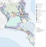
File:Cartography Land use.jpeg|''1.Land uses Cartography '' | File:Cartography Land use.jpeg|''1.Land uses Cartography '' | ||
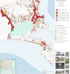
File:Historical_Cartography.jpeg|''2.Historical Cartography'' | File:Historical_Cartography.jpeg|''2.Historical Cartography'' | ||
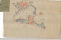
File: Carta tecnica 65.jpeg|''Cartography of 1965'' | |||
File:Piano_particolareggiato.jpeg|''3.Detailed plan of the port, 1969-1978'' | File:Piano_particolareggiato.jpeg|''3.Detailed plan of the port, 1969-1978'' | ||
</gallery> | </gallery> | ||
Revision as of 16:01, 13 April 2021
>>>back to working groups overview
Rationale
- The Miseno area is an important case study because it is a territory rich in resources.
- One can describe the potential of the area through three keywords: the first, from the Latin "acquarium", means "water tank"; water has been a resource for the territory since ancient times, in fact many of the archaeological sites of the area are aqueducts such as the "Piscina Mirabilis", "Grotta della Dragonara" and "Sacello degli Augustali".
- The second is "vacum", also from Latin, means "empty" that refers to the etymology of the term Bacoli that emphasizes the strong agricultural vocation of the area. In addition, Lake Miseno, an ecosystem of great environmental interest, is also conceived as a "void that fills up"; the lake was formed through the waters of the sea, which flowed into a volcanic crater.
- Finally, through the Latin term "otium", which underlines the tourist vocation of the area, since ancient times used by the Romans as a place for holidays.
- The area is shaped by history, it has numerous archaeological sites such as the "Toma di Agrippina", the "Roman Necropolis of Cappella" and others, but the maintenance of them and the bad connection with the center of Bacoli, makes it unattractive. The waters, especially lake Miseno, are polluted and a clean-up should be taken. An intervention for the change of territory concerns the redevelopment of the area, which surrounds the lake, where there are abandoned spaces, but also to increase and exploit the connection between the lake and the port.
Location and scope
Water as a natural system
Geomorphology, typologies and dynamics of water areas
- The Miseno Lake is located in the city of Bacoli, in the southern part of Hydrographic Bacin of Phlegrean Fields. It is separated from the sea by a sandy reef about 200 meters wide but is connected to it through two mouths: the first located near the town of Miliscola and the second located near the bay of Miseno.
Existing water bodies in the area:
1. Miseno Lake, which has an area of 40 hectares and a perimeter of 2800 meters. The average depth is 2.25 meters and the maximum depth is 4.
2. Fusaro Lake,The lake was formed with the closure of the stretch of sea between the hamlets of Torregaveta and Cuma. Its perimeter measures about 4.10 km and has an area of 0.97 km²
The Miseno lake is a salty lagoon, has his origins from the sea waters flowed into the crater of an ancient volcano and because of this phenomenon, it is called “Dead Sea”.
The backdrop mainly hard consisting of volcanic rock debris, is now covered by layers of muddy sediment anoxic and rich in nutrients that reach thicknesses of more than a metre along the north banksWest, North and East, in the current areas of slurry spillage and discharge.
- The Lake has two estuaries: the first, 250 meters long, is located near the town of Miniscola. In the past this estuary has been subject to frequent burials due to erosion and coastal transport and is, at present closed, at the disposal of the local health authorities in order to prevent contamination of the bathing water facing the beach of Miliscola. The second estuary is 100 m long, section 5 m2, communicates with the sea in the bay of Miseno and presents problems of reduced outflow to the sea where at the beginning the depth is reduced to about 30 cm.
There aren't natural sweet tributaries and the water exchanges are limited to the sea, however small, so the natural water exchange of the lake is extremely poor: about 4,5 years.
- The territory of Bacoli represent an environmental system and landscape of exceptional value, consisting of an inseparable intertwining between natural structure, historical training and agricultural use. This three factors have determined over time an ecosystem still in continuous evolution but whose fragility appears even more exposed today after the incessant transformations occurred between the 60’s and 90’s.
In addition, the high urbanisation of areas exposed to such phenomena, contributes to increasing the levels of risk associated with them.
The coastal zone of the Phlegrean Fields volcanic district is prone to a wide spectrum of natural hazards, including earthquakes, tsunamis, flash floods, ground deformation, landslides and coastal erosion.
The area of Bacoli is affected by the phenomenon of bradyseism, a slow vertical movement of the soil in a large area. is a cyclical phenomenon that can be associated with seismic phenomena of discrete intensity.
- In 2017 there was a violent storm, fell over 100-120 mm on a large area including Bacoli. (1/8 of what normally falls in a whole year). The rains provoked a series of critical situations on the territory, with vast flooding in the flat parts and abundant flows on the sloping areas, locally comparable to the processes of flash flooding.
- add 2-3 graphical representations to the image gallery, you can add more if you like
- Yourcase watersystem1.jpg
add a caption
- Yourcase watersystem2.jpg
add a caption
- Yourcase watersystem3.jpg
add a caption
Water as a living space
- The good climatic conditions and the presence of a fair percentage of humidity, due to the presence of the lakes, combined with the exceptional fertility of the soil, favored, at the end of the volcanic activity, the settlement of Apennine and Mediterranean plant species, which they are distributed according to the environmental conditions: this is why in the Phlegraean territory, in a small space, multiple plant associations coexist, which greatly raise the level of plant biodiversity in the area and, consequently, its ecological value.The Misenum is an ecosystem of great environmental interest, but it has long suffered from serious pollution problems caused by illegal discharges and often times the almost complete obstruction of the mouths.The environment of flora and fauna along the sea water have characteristics that partly also depend on the volcanic nature of the place.
- The lake is a brackish lagoon, it is connected to the sea by two mouths,one of Miseno and the other one of Miliscola, which after the recent adaptation they works allow the flow, controlled by locks, of sea water into the lake. There are no natural sweet tributaries, water exchanges are limited only with the sea.
- The historic center of the city of Bacoli has developed on the eastern shore of the lake; the south side is used for agricultural crops, there is a separation from the sea that forms a coastal strip, where the beach of Milliscola is located. The lake is surrounded by a cycle path, recently built, it represents an environmentally friendly tourist route. In addition to the important presence of the municipal villa that overlooks the lake and represents a large part of the public green area for Bacoli, there are abandoned land and structures.
- Are the rivers permeable for fish or blocked by artificial elements?(approx 200 signs)
Blue and Green Infrastructure
- The major potential elements of green infrastructure network are the areas of greenery aided around Lake Miseno, including the municipal villa, and the green paths that lead to the Lighthouse of Miseno; also there is a cycle path that extends from Baia, around the lake, to Capo Miseno, where a pedestrian path has connects the lake with the lighthouse. The areas around the lake are mostly abandoned or occupied by parking lots, the poor state of maintenance and pollution of the lake also devalues these cycle-pedestrian paths. These areas need redevelopment interventions, to enhance the territory and create a line of green infrastructures that can make the connection between Lake Miseno and Capo Miseno more attractive. While, for blue infrastructure, the major potential elements are Lake Miseno, the port of Miseno and the coastline: the coastline is occupied by tourist equipment, but here too there are some abandoned areas; while the waters are polluted due to waste.
Land use and water
- In image 1. a cartography is illustrated which highlights the various uses of the land; with a majority of agricultural and residential areas. The infrastructures are few but essential and almost all coexist in the city center.
- In image 2. illustrates how the human settlement system has expanded over time.
- In Roman times Miseno and the neighboring villages was a holiday resort. The remains of Cento Camerelle, part of the Piscina Mirabilis and the so-called Agrippina Tomb are still preserved today from the ancient Bauli. During the Augustan era, Bacoli became the elective capital of politics, culture and worldliness. After the fall of the Roman Empire, the city of Bacoli also declined due to some geological phenomena (bradyseism and erosions). In the 17th century the city was reborn and became one of the favorite destinations of Europeans. In addition to Bacoli today, the current municipality also includes the remains of the ancient Bauli, Miseno and its subsidiary Miliscola, former seat of the Roman Emperor's fleet.
The land use of the study area can change and is undergoing change, in fact the representatives of some associations, in defense of the Bacoli area, have shown us (during the Living Labs) intervention projects proposed for this change.
- Carta tecnica 65.jpeg
Cartography of 1965
Cultural and spatial typologies of water areas
- Which spatial patterns have evolved in relation to your water areas?
- What is the role of water areas within the overall urban morphology? (approx 200 signs)
- add 1-2 graphical representations to the image gallery, you can add more if you like
- Yourcase water space1.jpg
add a caption
- Yourcase water space2.jpg
add a caption
- Yourcase water space3.jpg
add a caption
Sacred spaces and heritage
- Which places/elements hold cultural value and to whom?
- You may add a map and some images, please also explain in your caption why these elements are valuable
- Your case sacredspace1.jpg
add a caption
- Your case sacredspace2.jpg
add a caption
- Your case sacredspace3.jpg
add a caption
Visual appearance and landscape narrative
- Which elements are essential for the landscape character?
- Has the landscape been painted or otherwise depicted, when and whom? Which elements are essential?
- Which narratives exist? Who has written about this landscape or depicted it in some way?
- You can add text and images
- Your case character1.jpg
add a caption
- Your case character2.jpg
add a caption
- Your case character3.jpg
add a caption
Water and People
Accessibility and usability
- Where are your water areas accessible, and where not? How strong are spatial obstacles preventing access?
- Who is using the spaces and how?
- Yourcase youraccessbilitymap.jpg
add a caption
- Yourcase usepatterns.jpg
add a caption
Community Mapping
What is to be mapped here?
- Social groups from within the community, for example the youth, kids, students, parents, the retired etc. Typically, these groups have specific needs, which you can also make explicit on the map. These people might not be organized in any way, but they are usually present in the context you are observing
- Local stakeholder groups: these groups are organized in one or the other way. They only exist within the community context you are observing. For example: the local community center, local churches, local interest groups, the landowners, small businesses and retailers
- External stakeholder groups are not necessarily present in the environment you are observing, but they may have strong stakes and interests. These can be local authorities, politicians, associations, care services etc.
- For each group, you may identify their needs, objectives, power and capacities
- You may also identify gaps and power conflicts
- Please try to redepict these elements in an integrated way and in relation to your water landscape. What is the relationship between these groups? Are they close or distanced from each other? Who is more powerful? Which voices are hardly heard? Do they have any shared concerns?
- Your case your community map1.jpg
add a caption
- Your case your community map2.jpg
add a caption
- Your case your community map3.jpg
add a caption
Possible Futures
- You can summarize your findings with a SWOT diagram and a DPSI(R) Model
- Link back to the Sustainable Development Goals: Which goals are at risk?
- What is your worst case scenario for this landscape?
- What is your best case scenario for this landscape?
- Present your scenarios in the form of a collage or sketch
- Add text and visuals
- Your case your spider diagram or dpsir model.jpg
explain your analysis briefly in the caption
- Your case yourworstcase visual.jpg
explain your worst case scenario briefly in the caption
- Your case yourbestcase visual.jpg
explain your best case scenario briefly in the caption
Collaborative Goal Setting
- Define strategic planning objectives based on the evaluation findings from your analysis
- Ideally, involve the community of your living labs into this process
- Link back to your original targets from section one and the Development Goals
- 150 words text contribution
Spatial Strategy and Transect
- translate your strategic goals into a vision
- develop a spatial translation of your vision
- exemplify your vision in the form of a transect with concrete interventions
- add map(s) and visualizations
- Your case spatial translaton vision.jpg
add caption here
- Your case transect.jpg
add caption here
- Your case transect detail1.jpg
add caption here
- Your case transect detail2.jpg
add caption here
From Theory of Change to Implementation
- For implementing your vision: Which partnerships are needed? Which governance model is required?
- Who needs to act and how? Draw and explain a change/process model/timeline
- Which resources are needed? On which assets can you build?
- add 150 words text and visuals
References
- give a full list of the references you have used for your case
Process Reflection
- Reflect in your intercultural and interdisciplinary team on the outcomes of your study
- Which limitations were you facing?
- What have you learnt from each other?
- What did you learn in the Living Labs?
- What would you do differently next time?
- You can also use diagrams/visuals
- 250 words text


