MIME search
Jump to navigation
Jump to search
This page enables the filtering of files for their MIME type.
Input: contenttype/subtype or contenttype/*, e.g. image/jpeg.
Showing below up to 50 results in range #101 to #150.
- (download) Parasite cities section.png . . 4,000 × 3,000 . . 1.65 MB . . Brent.brug . . 09:22, 18 July 2022
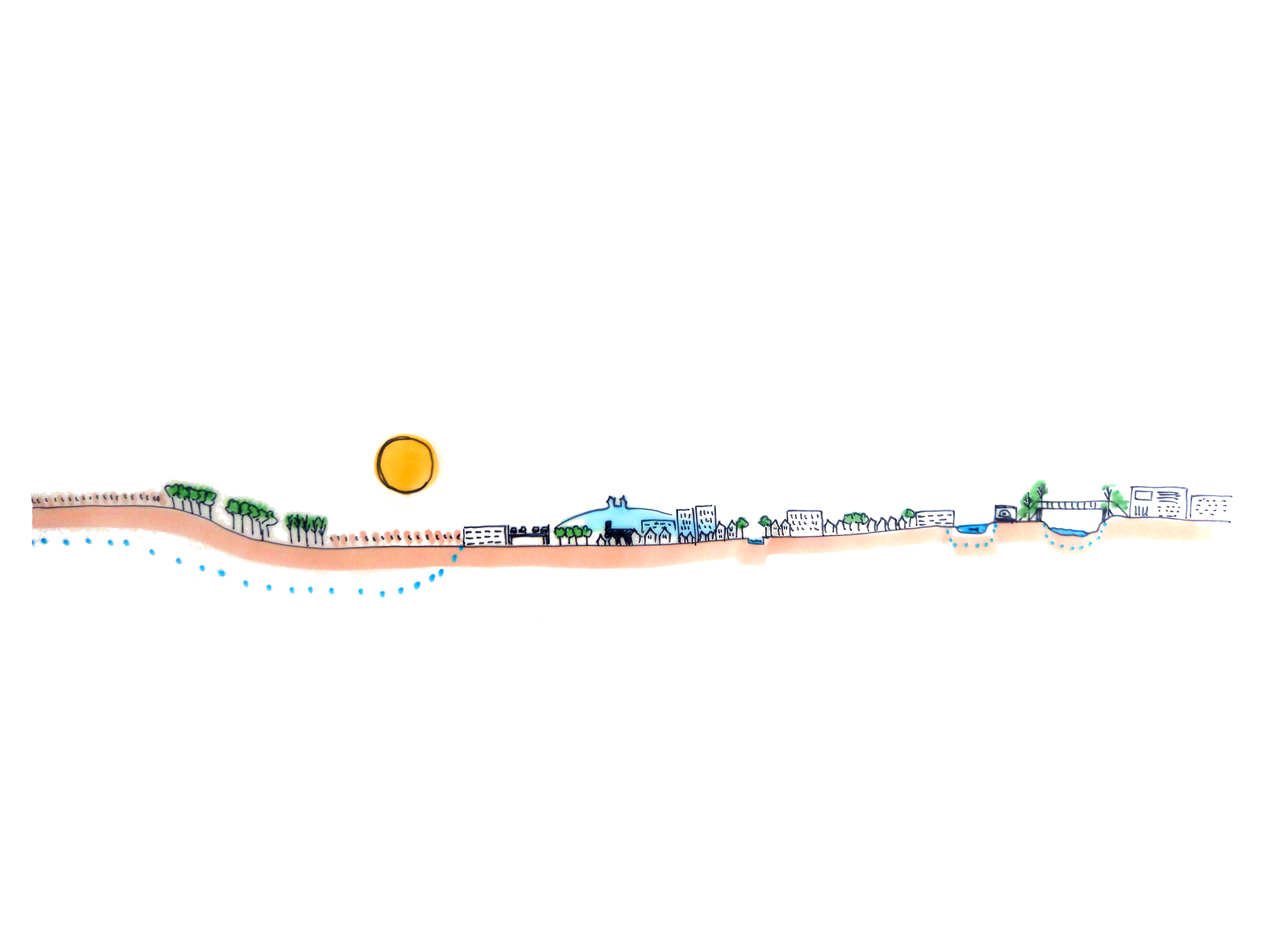
- (download) Suburbia section.png . . 4,000 × 3,000 . . 1.53 MB . . Brent.brug . . 09:22, 18 July 2022
- (download) Wild West section.png . . 4,000 × 3,000 . . 1.13 MB . . Brent.brug . . 09:23, 18 July 2022
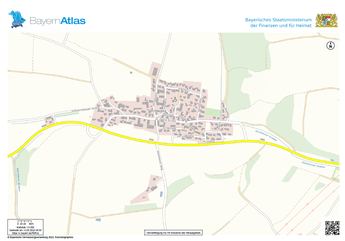
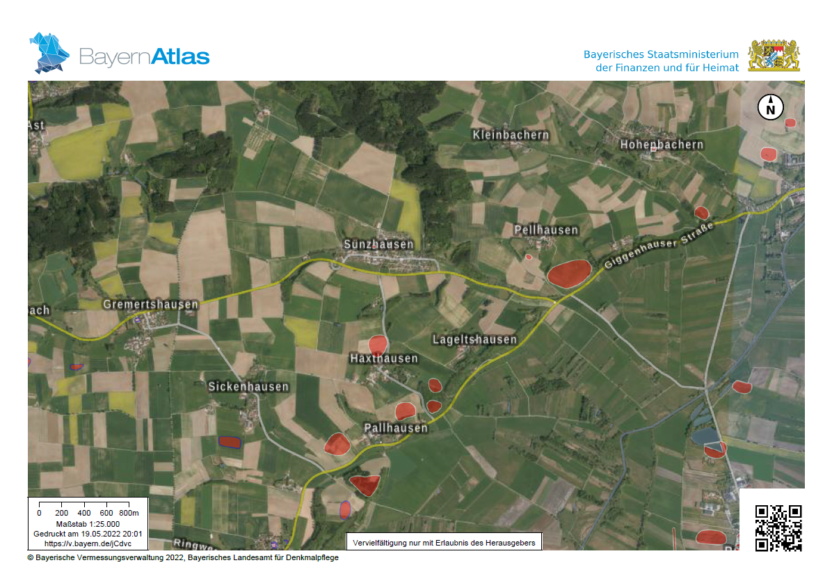
- (download) Sünzhausen BayernAtlas.PNG . . 1,186 × 828 . . 235 KB . . Cecile.agustoni . . 07:05, 13 May 2022
- (download) 1.1 surface stream flows.png . . 403 × 300 . . 334 KB . . Cecile.agustoni . . 18:46, 14 May 2022
- (download) 1.2. surface stream flows.png . . 402 × 300 . . 356 KB . . Cecile.agustoni . . 18:46, 14 May 2022
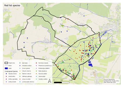
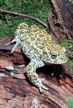
- (download) 1.3 Red List Species.png . . 423 × 300 . . 169 KB . . Cecile.agustoni . . 18:47, 14 May 2022
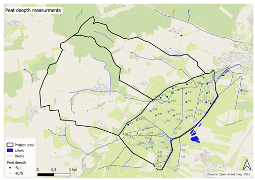
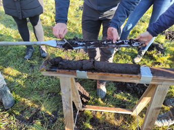
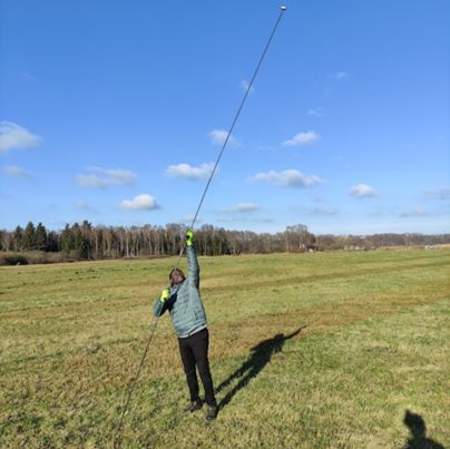
- (download) 1.7 Peat depth.png . . 503 × 354 . . 228 KB . . Cecile.agustoni . . 18:48, 14 May 2022
- (download) 1.8.png . . 344 × 258 . . 275 KB . . Cecile.agustoni . . 18:48, 14 May 2022
- (download) 1.9.png . . 404 × 403 . . 307 KB . . Cecile.agustoni . . 18:49, 14 May 2022
- (download) 1.5.png . . 235 × 345 . . 251 KB . . Cecile.agustoni . . 19:01, 14 May 2022
- (download) 2.1.PNG . . 440 × 602 . . 528 KB . . Cecile.agustoni . . 19:08, 14 May 2022
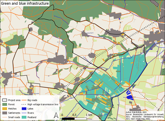
- (download) 1.11 Green and Blue infrastructure.png . . 560 × 410 . . 400 KB . . Cecile.agustoni . . 19:09, 14 May 2022
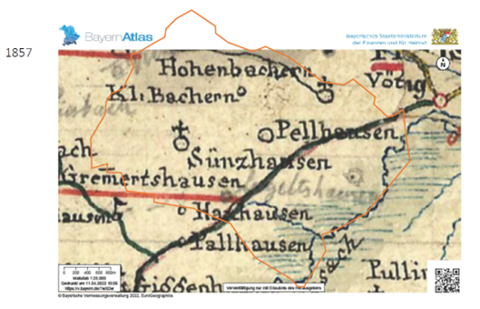
- (download) 2.3 Map of the area in 1857.png . . 529 × 340 . . 352 KB . . Cecile.agustoni . . 19:09, 14 May 2022
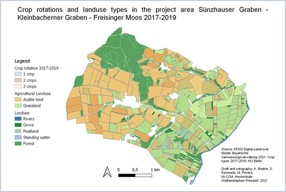
- (download) 1.10 Crop rotation.png . . 575 × 386 . . 233 KB . . Cecile.agustoni . . 19:10, 14 May 2022
- (download) 1.4.png . . 544 × 275 . . 1 KB . . Cecile.agustoni . . 19:44, 14 May 2022
- (download) 1.6.png . . 544 × 275 . . 1 KB . . Cecile.agustoni . . 16:58, 19 May 2022
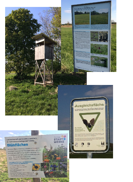
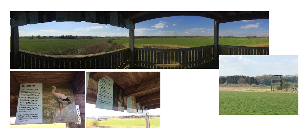
- (download) 2.7 Touristic use of the moos.PNG . . 1,063 × 466 . . 796 KB . . Cecile.agustoni . . 17:33, 19 May 2022
- (download) 2.8 The Hills were used mostly for agriculture on the sides and Woodlands on top MapBayernAtlas.png . . 339 × 236 . . 151 KB . . Cecile.agustoni . . 17:41, 19 May 2022
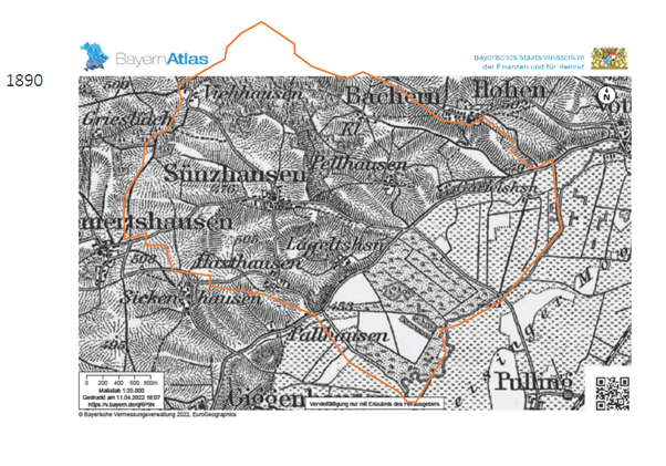
- (download) 2.9 Situation on the area around 1890 BayernAtlas.png . . 602 × 421 . . 256 KB . . Cecile.agustoni . . 17:42, 19 May 2022
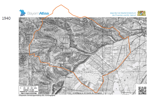
- (download) 2.10 Situation on the area around 1940 BayernAtlas.png . . 602 × 380 . . 233 KB . . Cecile.agustoni . . 17:42, 19 May 2022
- (download) Fritz Halberg-Krauss, Holzfäller im Freisinger Moos 1942.png . . 389 × 259 . . 266 KB . . Cecile.agustoni . . 17:52, 19 May 2022
- (download) 2.13 Map Denkmäler.PNG . . 1,196 × 845 . . 1.82 MB . . Cecile.agustoni . . 18:03, 19 May 2022
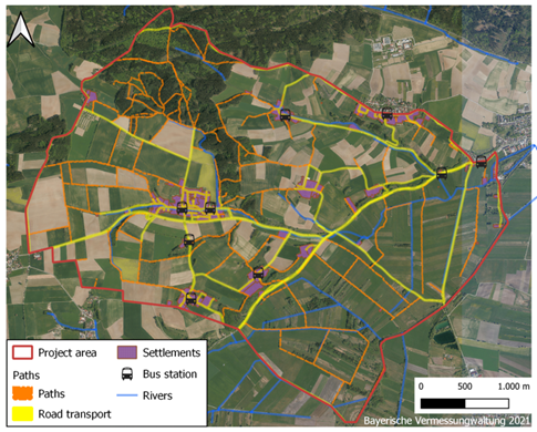
- (download) 3.1 Map Road transport and path map.png . . 485 × 390 . . 468 KB . . Cecile.agustoni . . 20:06, 19 May 2022
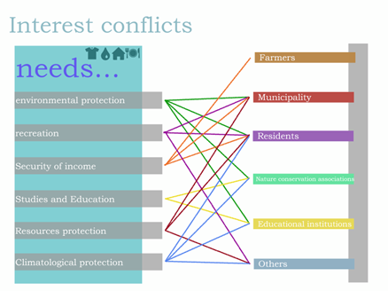
- (download) 3.3 graph Interest conflicts.png . . 438 × 328 . . 61 KB . . Cecile.agustoni . . 20:07, 19 May 2022
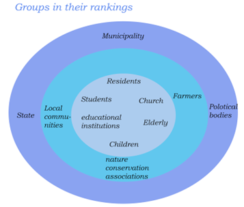
- (download) 3.4 graph groups in their rankings.png . . 357 × 303 . . 41 KB . . Cecile.agustoni . . 20:07, 19 May 2022
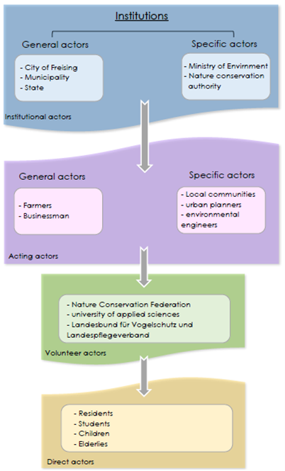
- (download) 3.5 Institutions.png . . 402 × 665 . . 104 KB . . Cecile.agustoni . . 20:07, 19 May 2022
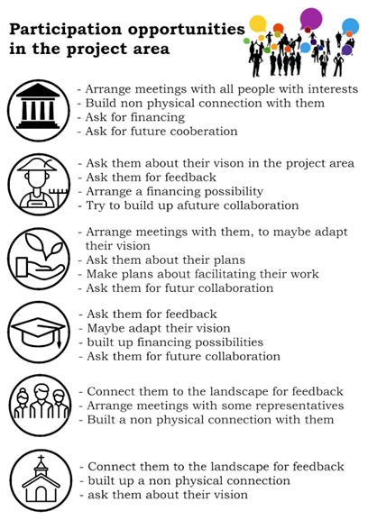
- (download) 3.6 participation opportunity in the project area.png . . 408 × 577 . . 106 KB . . Cecile.agustoni . . 20:08, 19 May 2022
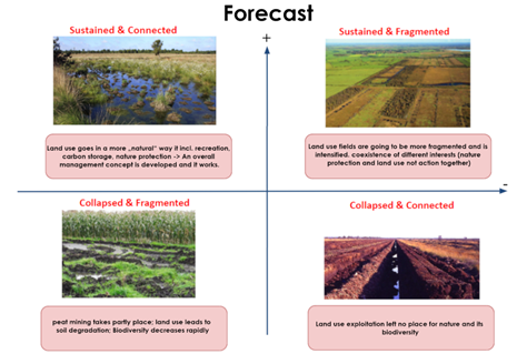
- (download) 4.1 Forecast - Pia Röder and Juan Miguel Ovalle.png . . 465 × 328 . . 160 KB . . Cecile.agustoni . . 20:09, 19 May 2022
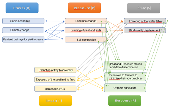
- (download) 4.2 Graph.png . . 572 × 367 . . 90 KB . . Cecile.agustoni . . 20:21, 19 May 2022
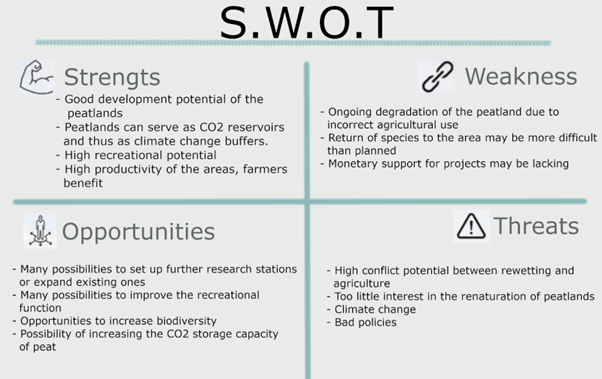
- (download) 4.3 SWOT.png . . 602 × 379 . . 105 KB . . Cecile.agustoni . . 20:21, 19 May 2022
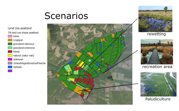
- (download) 4.4 Scenarios.png . . 602 × 373 . . 342 KB . . Cecile.agustoni . . 20:22, 19 May 2022
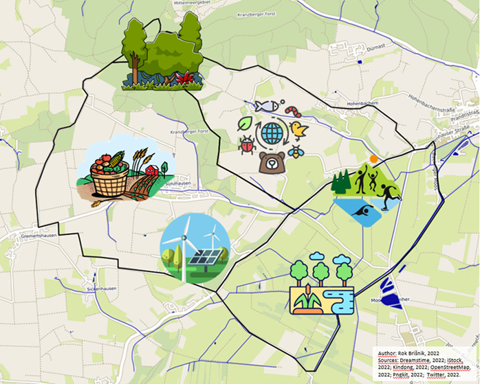
- (download) 5.1 Areas for green transformation (author Rok Brišnik, 2022).png . . 698 × 559 . . 701 KB . . Cecile.agustoni . . 20:48, 19 May 2022
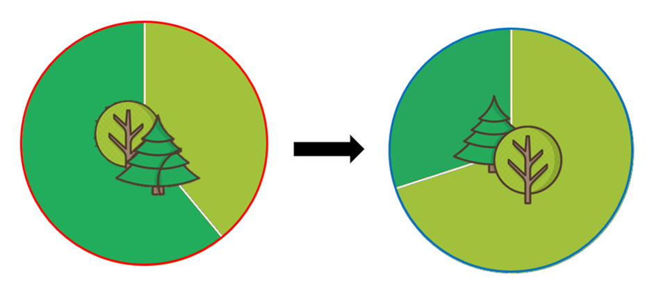
- (download) 5.2 Forest structure transformation.png . . 941 × 424 . . 124 KB . . Cecile.agustoni . . 20:49, 19 May 2022
- (download) 5.3 Construction of a trim track along the already existing infrastructure. Points with exercise aids would need to be constructed.png . . 941 × 662 . . 1.59 MB . . Cecile.agustoni . . 20:49, 19 May 2022
- (download) 5.4 Transformation of intensive agriculture to extensive mixed agriculture (author Rok Brišnik, 2022, source Euractiv, 2022)..png . . 941 × 407 . . 671 KB . . Cecile.agustoni . . 20:50, 19 May 2022
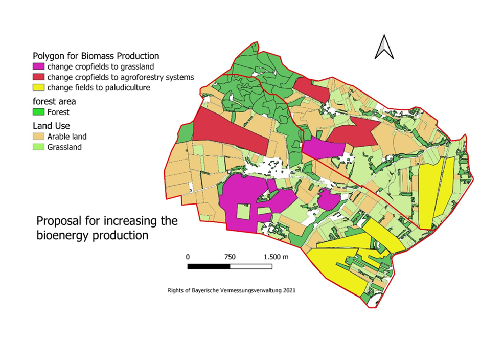
- (download) 5.5 Map of energy potential in project area (authors CCM stuents, 2022)..png . . 602 × 181 . . 152 KB . . Cecile.agustoni . . 20:50, 19 May 2022
- (download) 6.1.png . . 941 × 682 . . 70 KB . . Cecile.agustoni . . 16:26, 21 May 2022
- (download) 6.2.png . . 941 × 665 . . 519 KB . . Cecile.agustoni . . 16:28, 21 May 2022
- (download) Agriturismo.png . . 940 × 489 . . 1.15 MB . . Chiara.cavallo . . 09:54, 15 April 2022
- (download) Neubrandenburg Green and blue infrastructure..png . . 1,173 × 789 . . 1.34 MB . . David.pulido . . 20:55, 17 April 2021
- (download) Map revised Nb.png . . 1,309 × 921 . . 1.59 MB . . David.pulido . . 19:01, 30 May 2021
- (download) No Participation into the environment.png . . 1,024 × 768 . . 396 KB . . David.pulido . . 21:05, 19 June 2021
- (download) Participation into the environment.png . . 1,024 × 768 . . 1.21 MB . . David.pulido . . 21:05, 19 June 2021
- (download) Hidro bucuresti.png . . 1,026 × 1,313 . . 788 KB . . Denisa.lungu . . 18:02, 25 March 2021
- (download) Source - Managementul apei in Mun. Bucuresti, O. Cocoș, Editura Ars Docendi, 2006.png . . 1,313 × 1,026 . . 702 KB . . Denisa.lungu . . 19:29, 25 March 2021
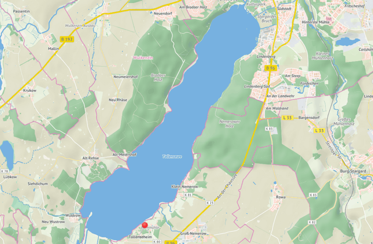
- (download) Tollensee.PNG . . 1,230 × 805 . . 1.25 MB . . Devi.anilkumar . . 13:44, 29 April 2021
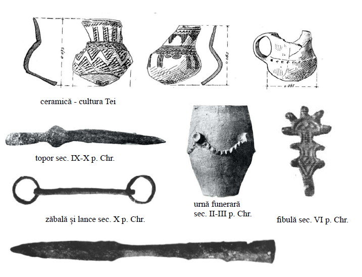
- (download) Objects found in Tei Lake Archaeological Site.PNG . . 717 × 548 . . 194 KB . . Diana-ioana.ristea . . 21:12, 19 April 2021
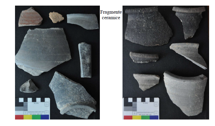
- (download) Objects found in Tei Toboc Archaeological Site.PNG . . 730 × 427 . . 411 KB . . Diana-ioana.ristea . . 21:12, 19 April 2021
- (download) The route of the pedestrian and cycle path along the main Green-Blue Axis of Bucharest-min.png . . 1,600 × 1,341 . . 1.07 MB . . Diana-ioana.ristea . . 23:35, 26 May 2021
.png)
..png)
..png)