Help
File list
Jump to navigation
Jump to search
This special page shows all uploaded files.
File list
Items per page:
20
50
100
250
500
Username:
Include old versions of files
Show file list
First page
Previous page
Next page
Last page
Date
Name
Thumbnail
Size
User
Description
Versions
09:16, 20 May 2022
Urban sprawl spider diagram 1.jpg
(
file
)
44 KB
Brent.brug
(
talk
|
contribs
)
1
09:15, 20 May 2022
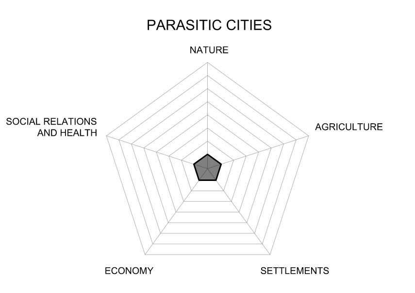
Parasite cities spider diagram 1.jpg
(
file
)
43 KB
Brent.brug
(
talk
|
contribs
)
1
09:15, 20 May 2022
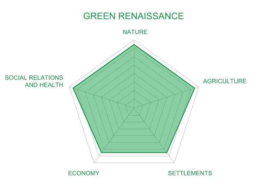
Green renaissance spider diagram 1.jpg
(
file
)
43 KB
Brent.brug
(
talk
|
contribs
)
1
09:15, 20 May 2022
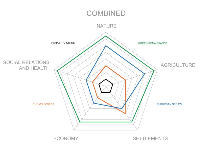
Combined spider diagrams 1.jpg
(
file
)
51 KB
Brent.brug
(
talk
|
contribs
)
1
09:10, 20 May 2022
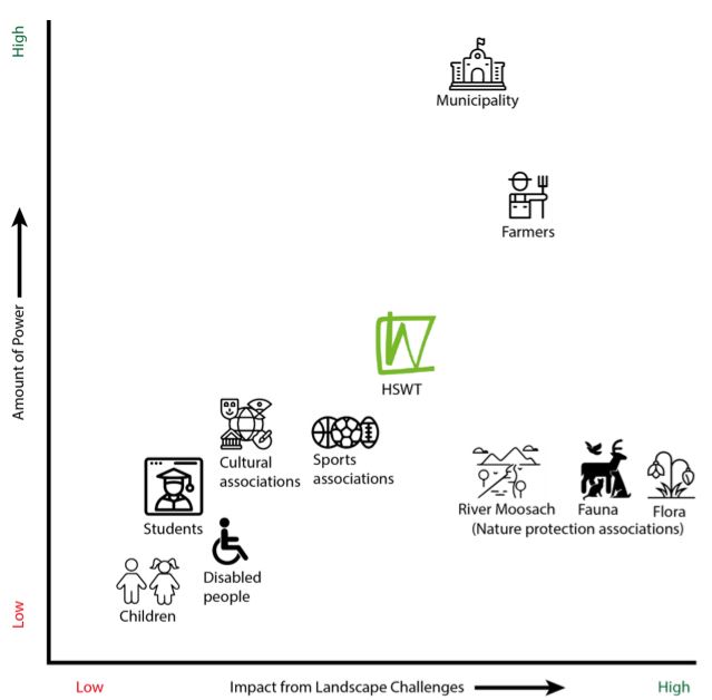
Community power mapping.jpg
(
file
)
38 KB
Brent.brug
(
talk
|
contribs
)
1
09:10, 20 May 2022
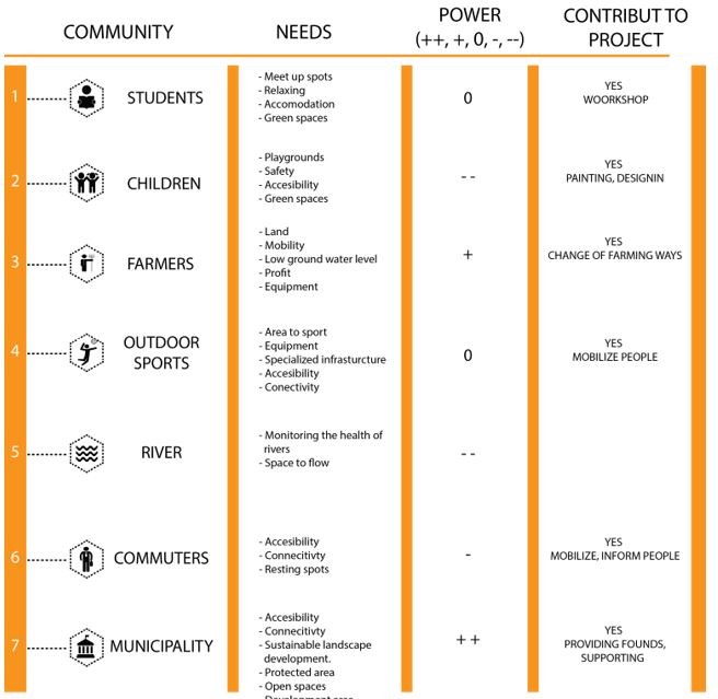
Community needs.jpg
(
file
)
62 KB
Brent.brug
(
talk
|
contribs
)
1
09:09, 20 May 2022
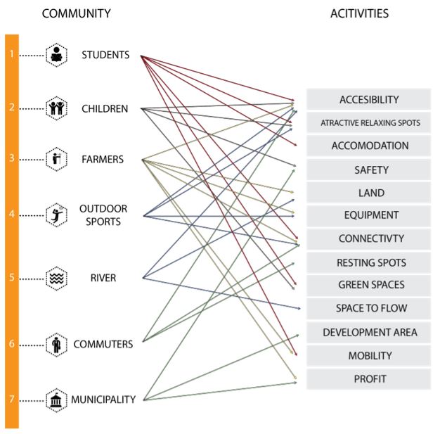
Community conflicts.jpg
(
file
)
62 KB
Brent.brug
(
talk
|
contribs
)
1
09:08, 20 May 2022
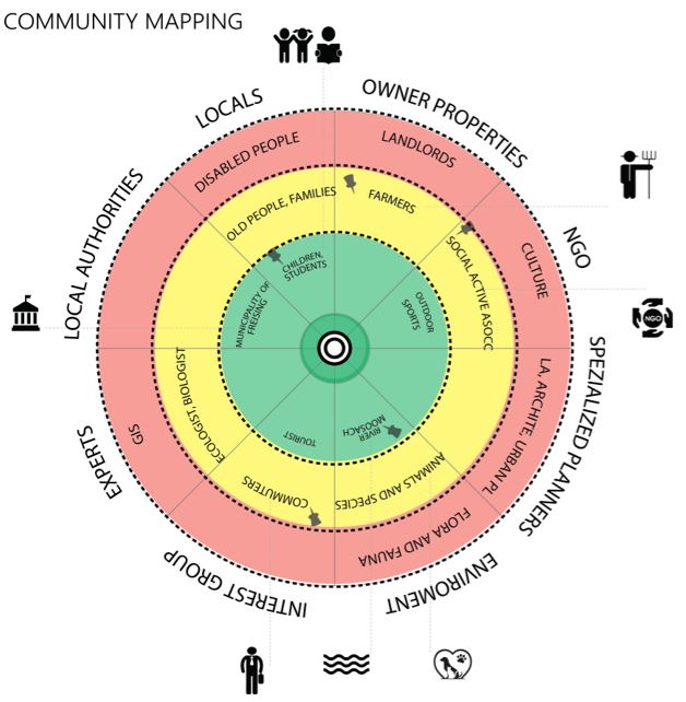
Community mapping 2.jpg
(
file
)
63 KB
Brent.brug
(
talk
|
contribs
)
1
09:00, 20 May 2022
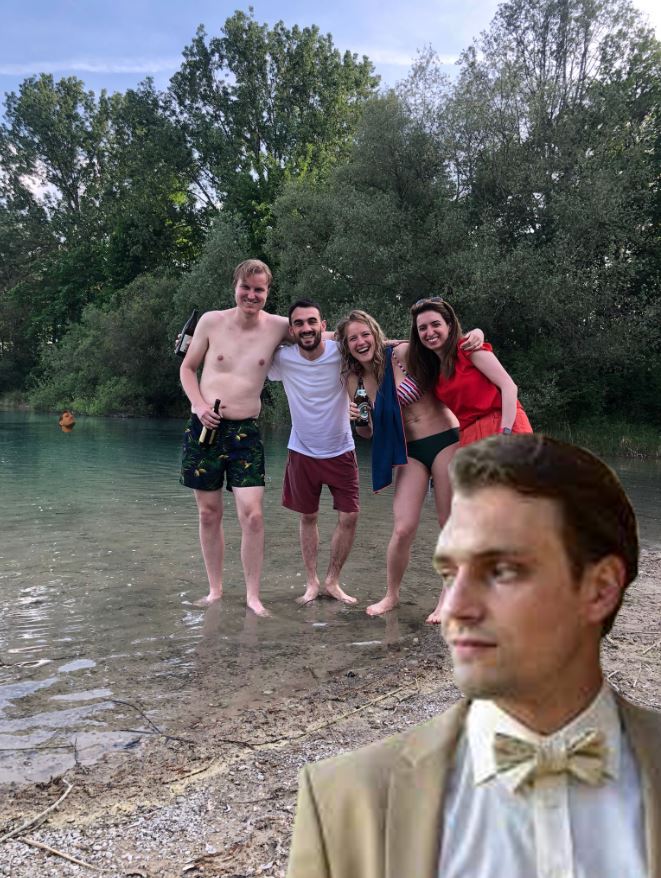
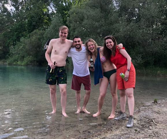
Group photo 2.jpg
(
file
)
141 KB
Brent.brug
(
talk
|
contribs
)
1
08:55, 20 May 2022
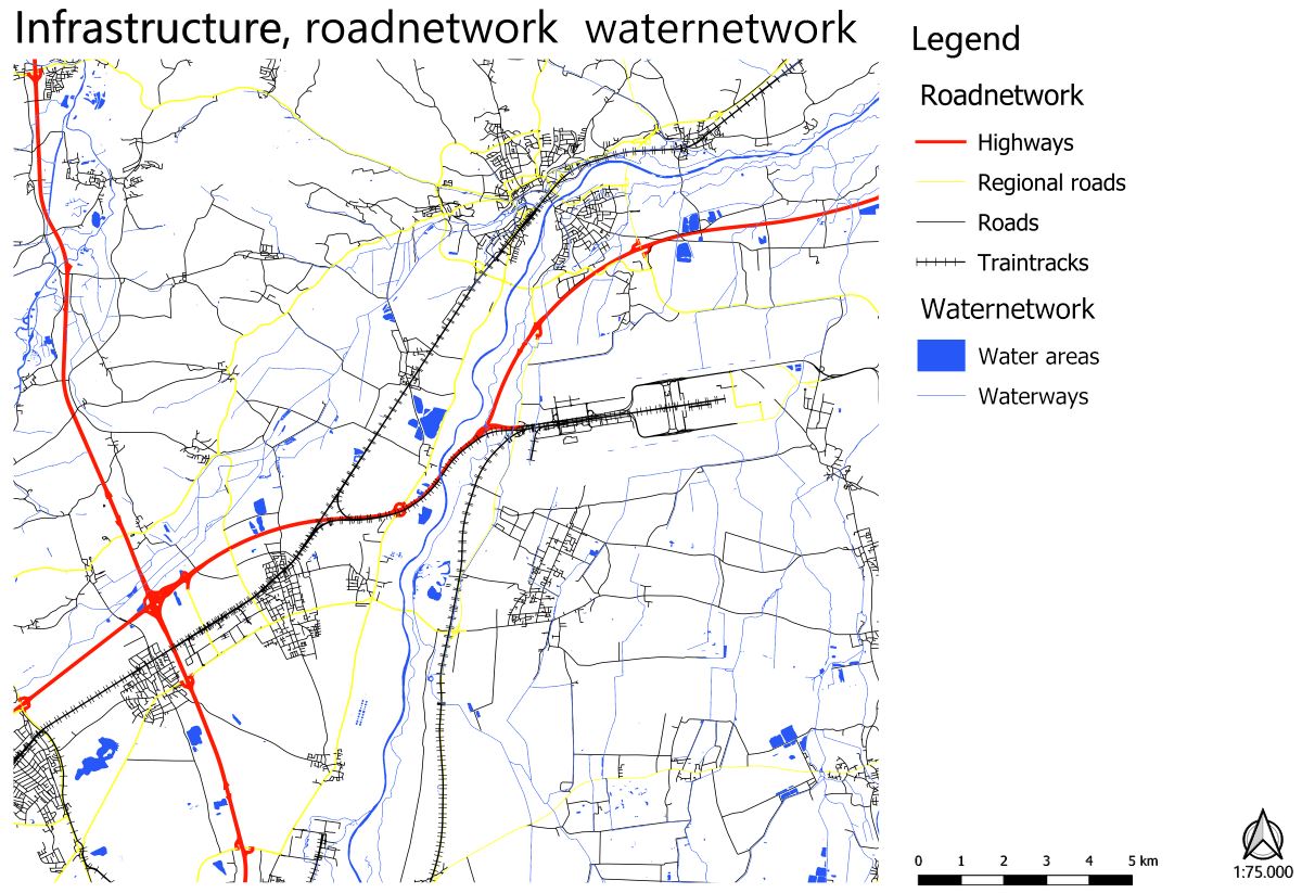
Road and water network cut-out.jpg
(
file
)
197 KB
Brent.brug
(
talk
|
contribs
)
1
08:49, 20 May 2022
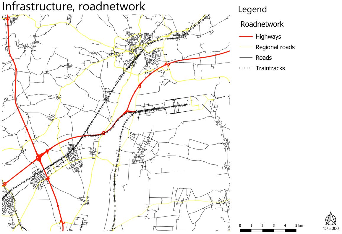
Roadnetwork large scale cut-out.jpg
(
file
)
143 KB
Brent.brug
(
talk
|
contribs
)
1
08:42, 20 May 2022
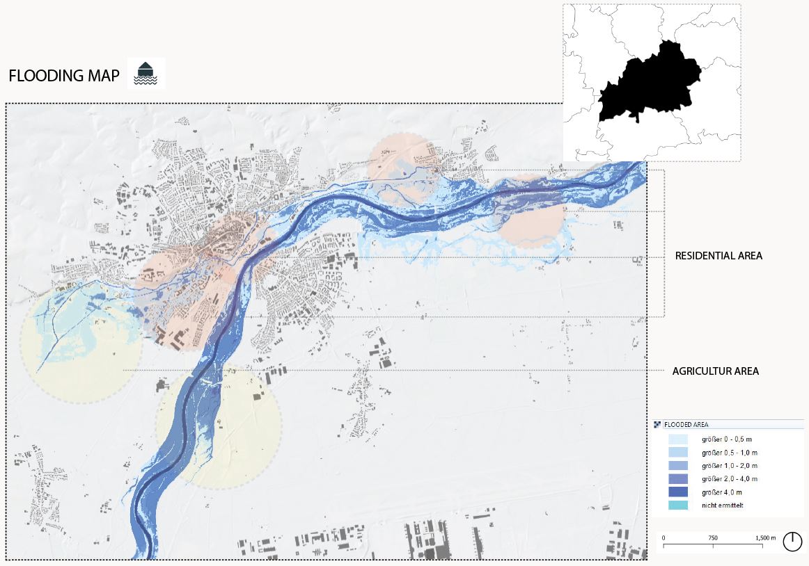
Floodplains cut-out.jpg
(
file
)
128 KB
Brent.brug
(
talk
|
contribs
)
1
08:32, 20 May 2022
View of weihenstephaner berg photo.jpg
(
file
)
12 KB
Brent.brug
(
talk
|
contribs
)
1
08:31, 20 May 2022
Small in the city photo.jpg
(
file
)
12 KB
Brent.brug
(
talk
|
contribs
)
1
08:31, 20 May 2022
Next to gardens photo.jpg
(
file
)
12 KB
Brent.brug
(
talk
|
contribs
)
1
08:30, 20 May 2022
Next to forest-hill photo.jpg
(
file
)
12 KB
Brent.brug
(
talk
|
contribs
)
1
08:30, 20 May 2022
Next to farmland photo.jpg
(
file
)
11 KB
Brent.brug
(
talk
|
contribs
)
1
08:30, 20 May 2022
In the open fields photo.jpg
(
file
)
12 KB
Brent.brug
(
talk
|
contribs
)
1
08:24, 20 May 2022
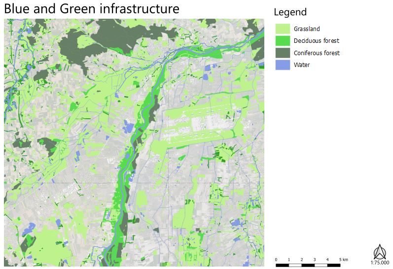
Blue and green infrastructure cut-out.jpg
(
file
)
85 KB
Brent.brug
(
talk
|
contribs
)
1
08:05, 20 May 2022
Moosach south of pulling section cut-out.jpg
(
file
)
32 KB
Brent.brug
(
talk
|
contribs
)
1
08:05, 20 May 2022
Moosach pulling to freising section cut-out.jpg
(
file
)
27 KB
Brent.brug
(
talk
|
contribs
)
1
08:05, 20 May 2022
Moosach in the city section cut-out.jpg
(
file
)
44 KB
Brent.brug
(
talk
|
contribs
)
1
08:00, 20 May 2022
Context cut-out.jpg
(
file
)
132 KB
Brent.brug
(
talk
|
contribs
)
1
07:46, 20 May 2022
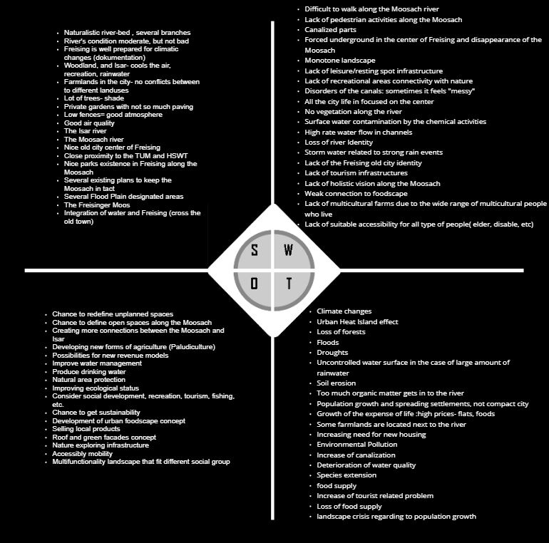
SWOT analysis combined cut-out.jpg
(
file
)
113 KB
Brent.brug
(
talk
|
contribs
)
1
07:43, 20 May 2022
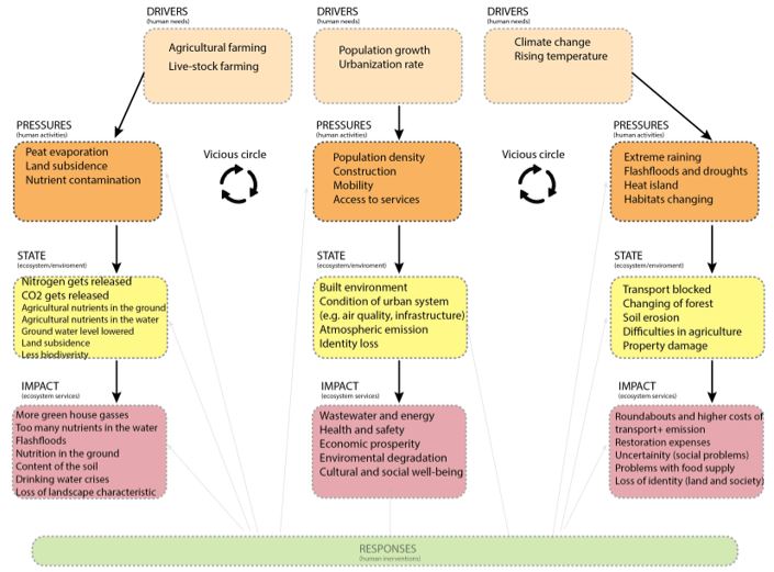
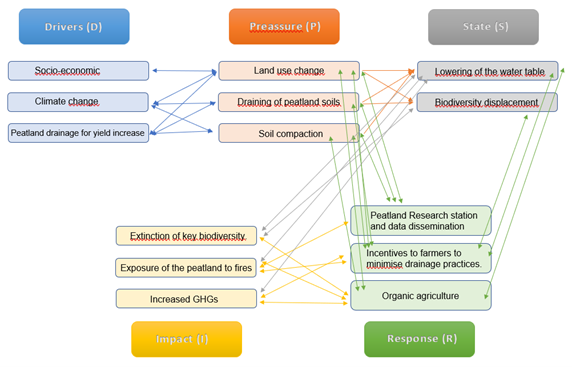
DPSIR cut-out.jpg
(
file
)
66 KB
Brent.brug
(
talk
|
contribs
)
1
07:42, 20 May 2022
Land-use map cut-out.jpg
(
file
)
142 KB
Brent.brug
(
talk
|
contribs
)
1
07:33, 20 May 2022
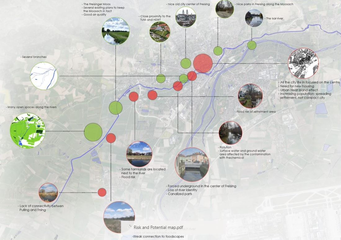
Risk and potential cut-out.jpg
(
file
)
132 KB
Brent.brug
(
talk
|
contribs
)
1
07:13, 20 May 2022
Group photo small.jpg
(
file
)
76 KB
Brent.brug
(
talk
|
contribs
)
1
23:23, 19 May 2022
Urban area.jpg
(
file
)
577 KB
Ayse.dolanbay
(
talk
|
contribs
)
1
23:21, 19 May 2022
Rural part.jpg
(
file
)
759 KB
Ayse.dolanbay
(
talk
|
contribs
)
1
23:20, 19 May 2022
Homemade infrastructure.jpg
(
file
)
516 KB
Ayse.dolanbay
(
talk
|
contribs
)
1
23:18, 19 May 2022
Urban development.jpg
(
file
)
492 KB
Ayse.dolanbay
(
talk
|
contribs
)
1
23:16, 19 May 2022
Constructions.jpg
(
file
)
814 KB
Ayse.dolanbay
(
talk
|
contribs
)
1
23:15, 19 May 2022
Shallow areas.jpg
(
file
)
820 KB
Ayse.dolanbay
(
talk
|
contribs
)
1
23:10, 19 May 2022
Enjoy water.jpg
(
file
)
824 KB
Ayse.dolanbay
(
talk
|
contribs
)
1
23:08, 19 May 2022
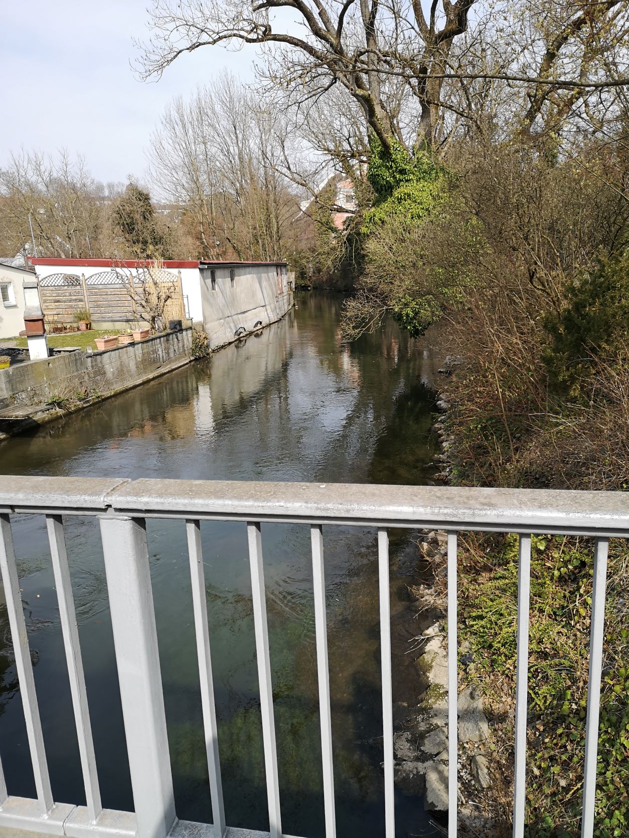
Modified River.jpg
(
file
)
582 KB
Ayse.dolanbay
(
talk
|
contribs
)
1
23:07, 19 May 2022
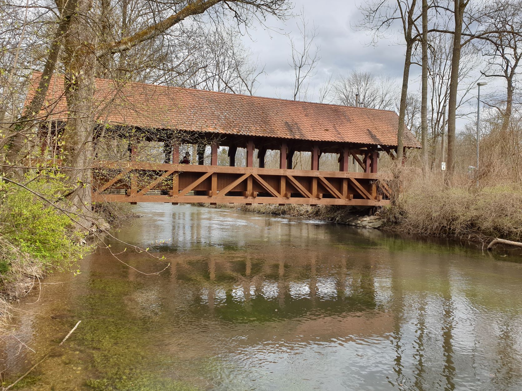
Wooden bridge.jpg
(
file
)
637 KB
Ayse.dolanbay
(
talk
|
contribs
)
1
21:49, 19 May 2022
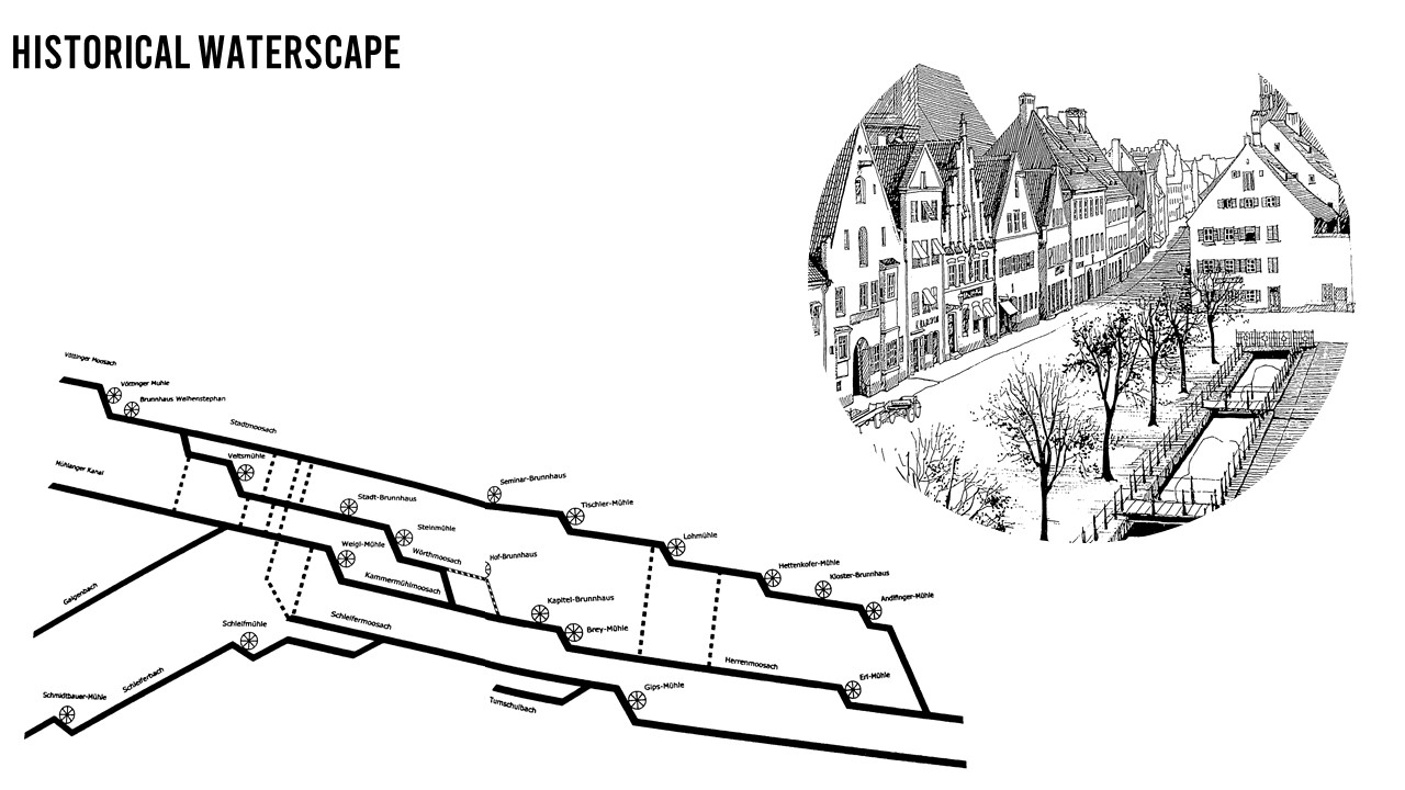
Mills.jpg
(
file
)
170 KB
Ayse.dolanbay
(
talk
|
contribs
)
1
21:29, 19 May 2022
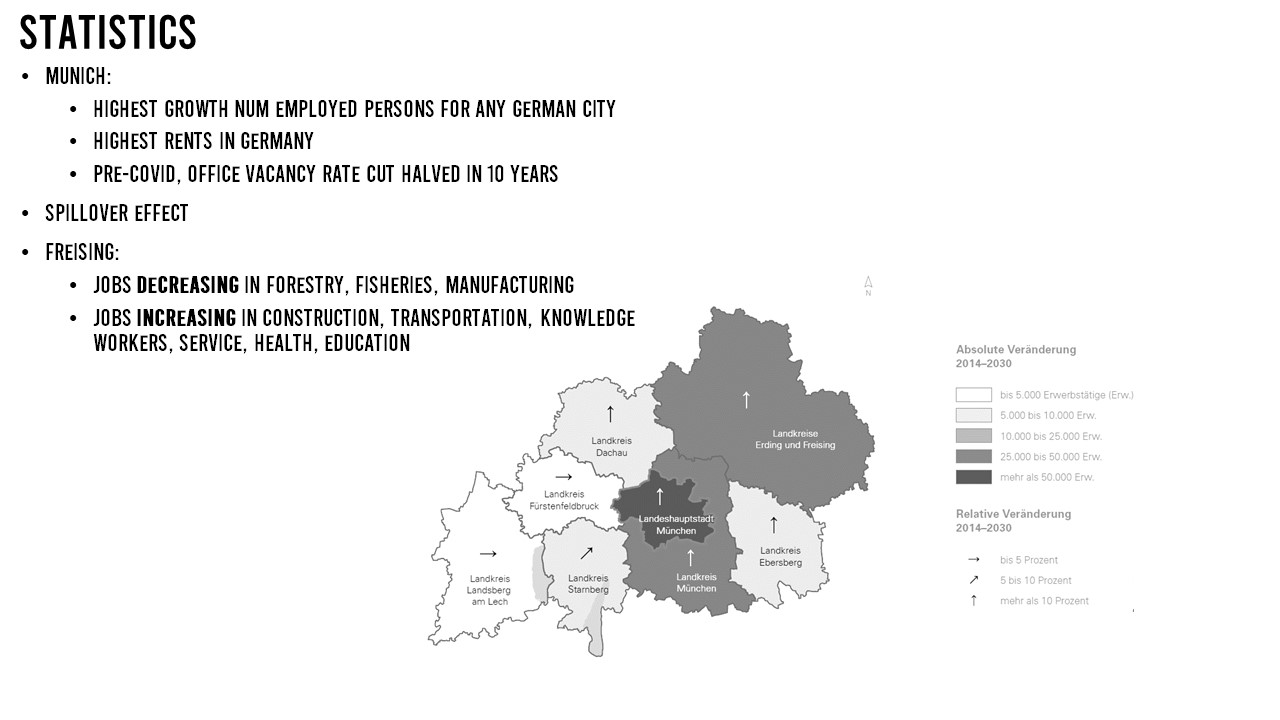
Statistic.jpg
(
file
)
98 KB
Ayse.dolanbay
(
talk
|
contribs
)
1
21:25, 19 May 2022
Businesses3.png
(
file
)
1.09 MB
Ayse.dolanbay
(
talk
|
contribs
)
1
20:50, 19 May 2022
5.5 Map of energy potential in project area (authors CCM stuents, 2022)..png
(
file
)
152 KB
Cecile.agustoni
(
talk
|
contribs
)
1
20:50, 19 May 2022
5.4 Transformation of intensive agriculture to extensive mixed agriculture (author Rok Brišnik, 2022, source Euractiv, 2022)..png
(
file
)
671 KB
Cecile.agustoni
(
talk
|
contribs
)
1
20:49, 19 May 2022
5.3 Construction of a trim track along the already existing infrastructure. Points with exercise aids would need to be constructed.png
(
file
)
1.59 MB
Cecile.agustoni
(
talk
|
contribs
)
1
20:49, 19 May 2022
5.2 Forest structure transformation.png
(
file
)
124 KB
Cecile.agustoni
(
talk
|
contribs
)
1
20:48, 19 May 2022
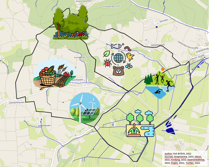
5.1 Areas for green transformation (author Rok Brišnik, 2022).png
(
file
)
701 KB
Cecile.agustoni
(
talk
|
contribs
)
1
20:22, 19 May 2022
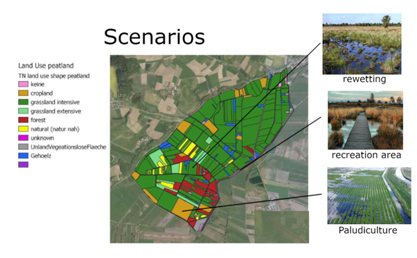
4.4 Scenarios.png
(
file
)
342 KB
Cecile.agustoni
(
talk
|
contribs
)
Graph - Scenario by Pia Röder Picture sources: recreation picture source: fotocommunity 17.05.22 Steg im Moor: halali magazin 01/2021 Rewetting: Marisa04, pixabay.com (2022)
1
20:21, 19 May 2022
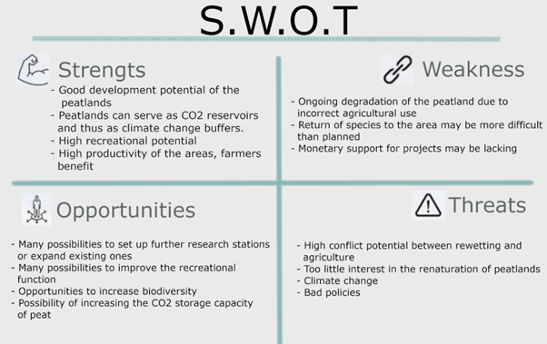
4.3 SWOT.png
(
file
)
105 KB
Cecile.agustoni
(
talk
|
contribs
)
1
20:21, 19 May 2022
4.2 Graph.png
(
file
)
90 KB
Cecile.agustoni
(
talk
|
contribs
)
1
20:09, 19 May 2022
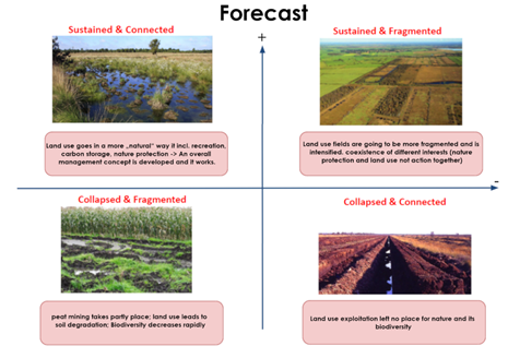
4.1 Forecast - Pia Röder and Juan Miguel Ovalle.png
(
file
)
160 KB
Cecile.agustoni
(
talk
|
contribs
)
Forecast - Pia Röder and Juan Miguel Ovalle Picture Sources: upper left: Marisa04, pixabay.com (2022) upper right: - lower left: Ludger Frye 2012 (NABU) lower right: Christian Fischer 31. Dezember 1986 (Wikipedia)
1
20:08, 19 May 2022
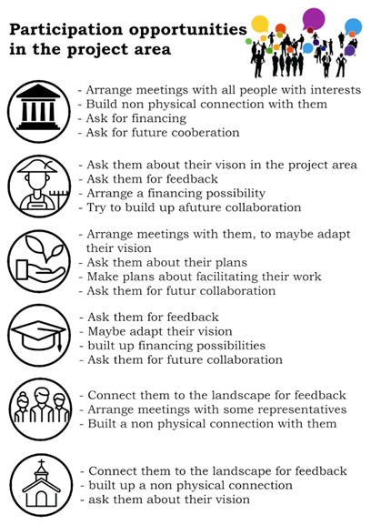
3.6 participation opportunity in the project area.png
(
file
)
106 KB
Cecile.agustoni
(
talk
|
contribs
)
1
First page
Previous page
Next page
Last page
Navigation menu
Personal tools
Log in
Namespaces
Special page
English
Views
More
Refresh
Search
The WAVE Project
About
Output
Multiplier Event
Online Seminar 2022
Overview
Schedule
Working Groups
Reading List
Geodesign
Living Labs
Overview
Living Lab Methods
Past Seminars
WAVE Seminar 2021
Working Groups 2021
Help + Navigation
Wiki tutorial
Templates
Recent changes
Help
Tools
Special pages
Printable version


..png)
..png)


.png)


