Uploads by Brent.brug
Jump to navigation
Jump to search
This special page shows all uploaded files.
| Date | Name | Thumbnail | Size | Description | Versions |
|---|---|---|---|---|---|
| 12:06, 20 May 2022 | Moosach and berg.jpg (file) |  |
124 KB | 1 | |
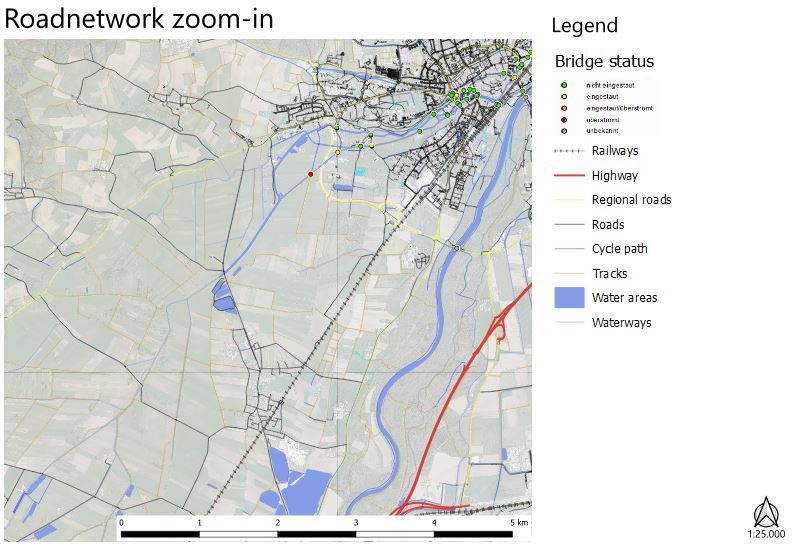
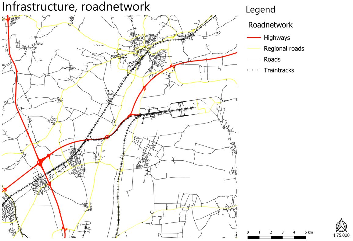
| 10:05, 20 May 2022 | Roadnetwork zoom-in cut-out.jpg (file) |  |
85 KB | 1 | |
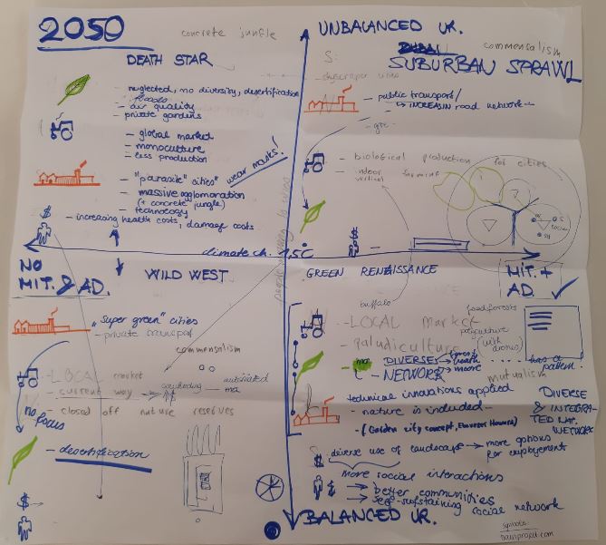
| 09:21, 20 May 2022 | Scenario drawing WIP.jpg (file) |  |
74 KB | 1 | |
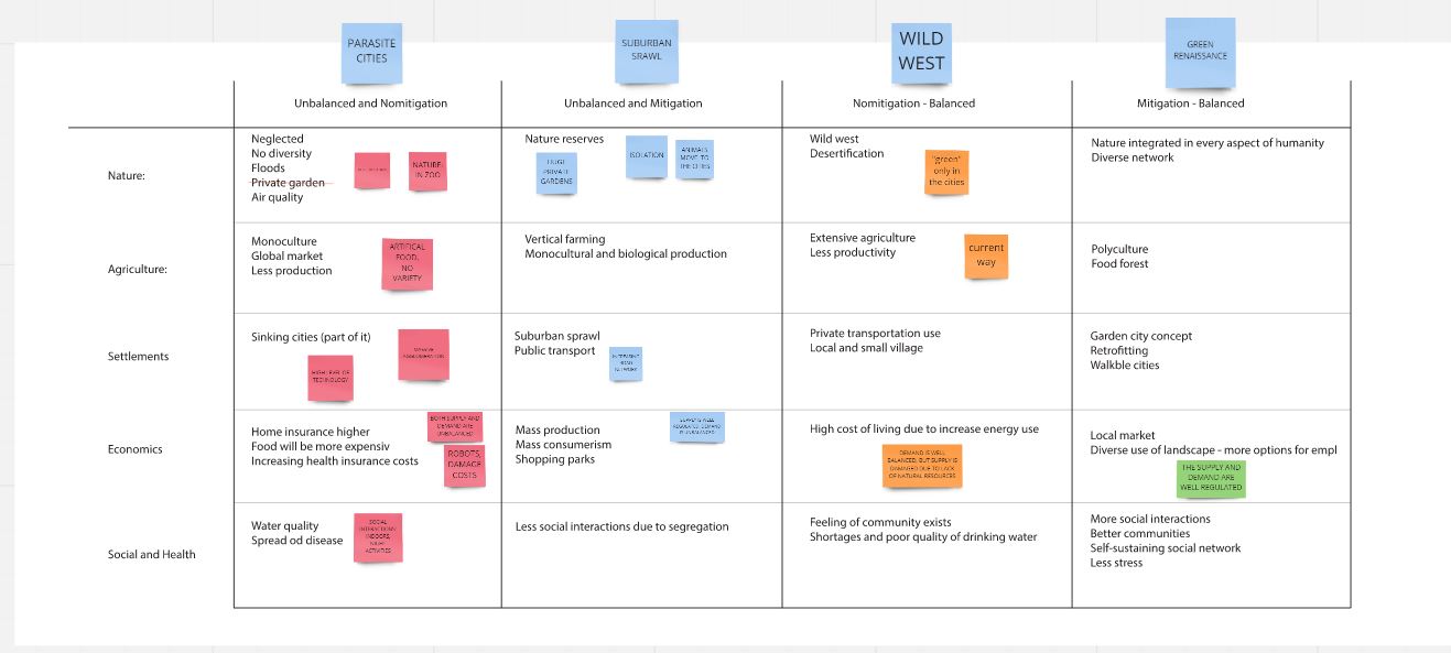
| 09:20, 20 May 2022 | Scenarios table WIP1.jpg (file) |  |
87 KB | 1 | |
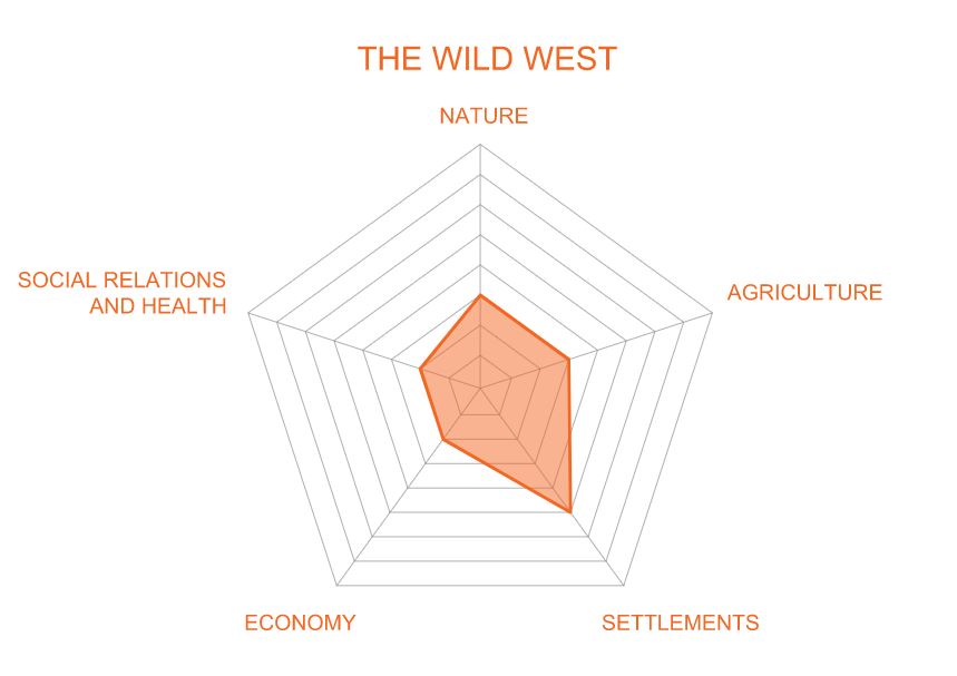
| 09:16, 20 May 2022 | Wild west spider diagram 1.jpg (file) |  |
42 KB | 1 | |
| 09:16, 20 May 2022 | Urban sprawl spider diagram 1.jpg (file) |  |
44 KB | 1 | |
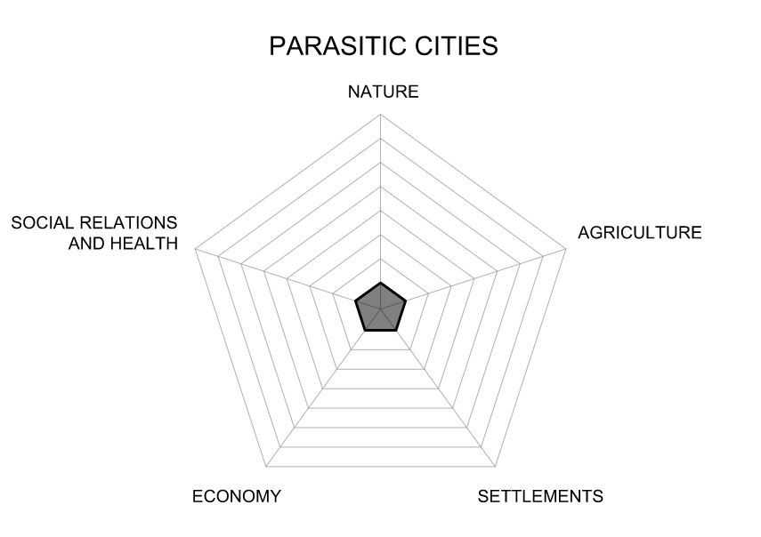
| 09:15, 20 May 2022 | Parasite cities spider diagram 1.jpg (file) |  |
43 KB | 1 | |
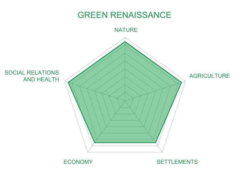
| 09:15, 20 May 2022 | Green renaissance spider diagram 1.jpg (file) |  |
43 KB | 1 | |
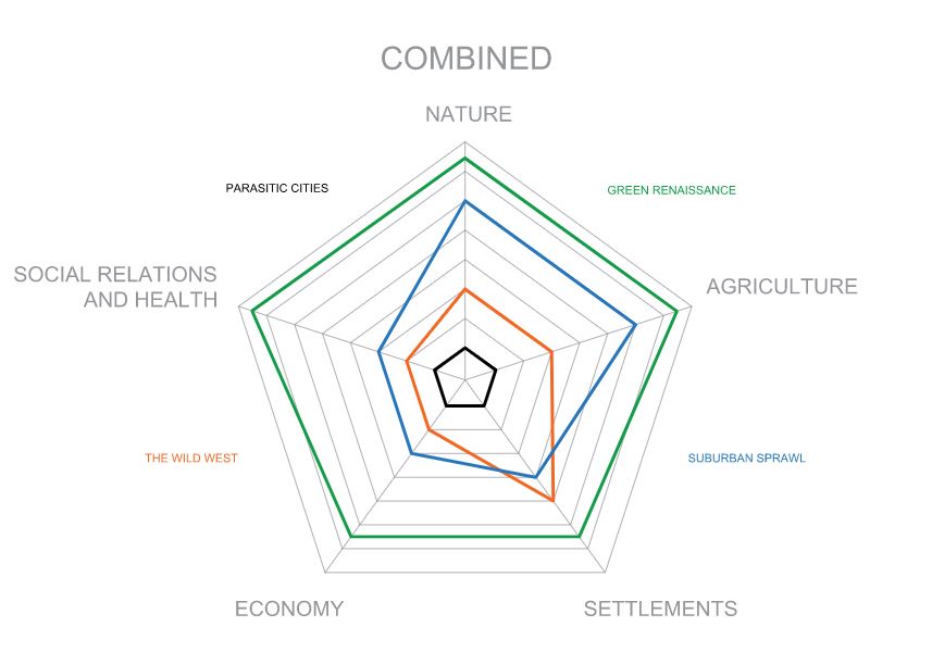
| 09:15, 20 May 2022 | Combined spider diagrams 1.jpg (file) |  |
51 KB | 1 | |
| 09:10, 20 May 2022 | Community power mapping.jpg (file) |  |
38 KB | 1 | |
| 09:10, 20 May 2022 | Community needs.jpg (file) |  |
62 KB | 1 | |
| 09:09, 20 May 2022 | Community conflicts.jpg (file) |  |
62 KB | 1 | |
| 09:08, 20 May 2022 | Community mapping 2.jpg (file) |  |
63 KB | 1 | |
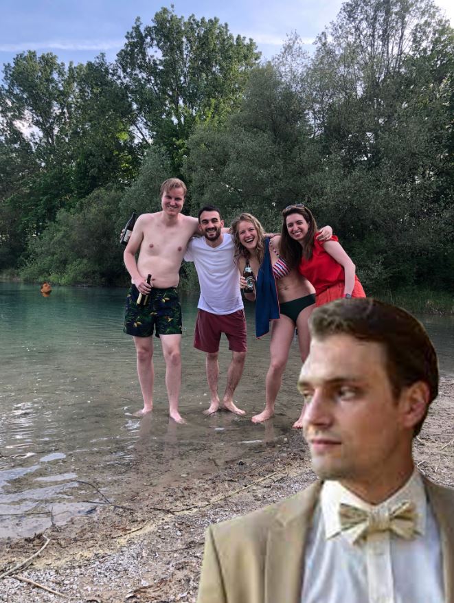
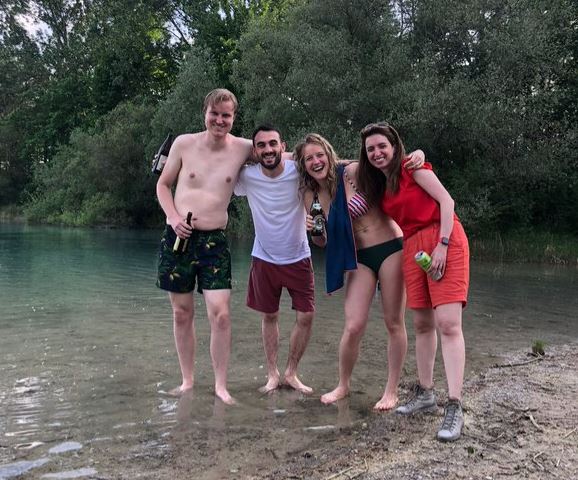
| 09:00, 20 May 2022 | Group photo 2.jpg (file) |  |
141 KB | 1 | |
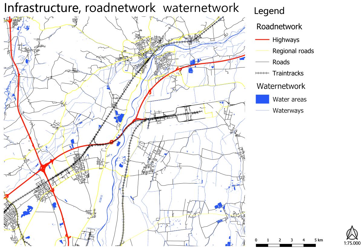
| 08:55, 20 May 2022 | Road and water network cut-out.jpg (file) |  |
197 KB | 1 | |
| 08:49, 20 May 2022 | Roadnetwork large scale cut-out.jpg (file) |  |
143 KB | 1 | |
| 08:42, 20 May 2022 | Floodplains cut-out.jpg (file) |  |
128 KB | 1 | |
| 08:32, 20 May 2022 | View of weihenstephaner berg photo.jpg (file) |  |
12 KB | 1 | |
| 08:31, 20 May 2022 | Small in the city photo.jpg (file) |  |
12 KB | 1 | |
| 08:31, 20 May 2022 | Next to gardens photo.jpg (file) |  |
12 KB | 1 | |
| 08:30, 20 May 2022 | Next to forest-hill photo.jpg (file) |  |
12 KB | 1 | |
| 08:30, 20 May 2022 | Next to farmland photo.jpg (file) |  |
11 KB | 1 | |
| 08:30, 20 May 2022 | In the open fields photo.jpg (file) |  |
12 KB | 1 | |
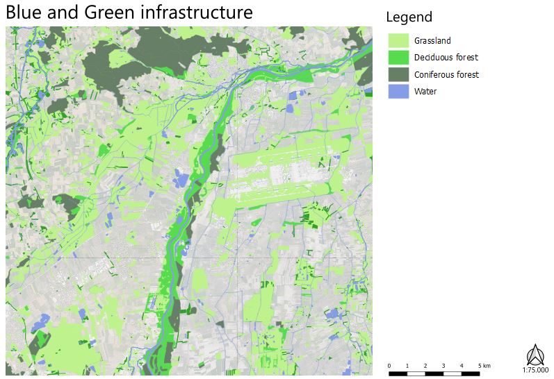
| 08:24, 20 May 2022 | Blue and green infrastructure cut-out.jpg (file) |  |
85 KB | 1 | |
| 08:05, 20 May 2022 | Moosach south of pulling section cut-out.jpg (file) |  |
32 KB | 1 | |
| 08:05, 20 May 2022 | Moosach pulling to freising section cut-out.jpg (file) |  |
27 KB | 1 | |
| 08:05, 20 May 2022 | Moosach in the city section cut-out.jpg (file) |  |
44 KB | 1 | |
| 08:00, 20 May 2022 | Context cut-out.jpg (file) |  |
132 KB | 1 | |
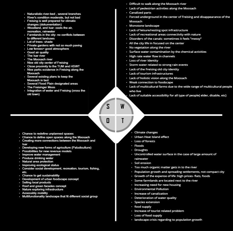
| 07:46, 20 May 2022 | SWOT analysis combined cut-out.jpg (file) |  |
113 KB | 1 | |
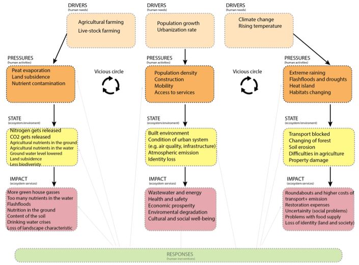
| 07:43, 20 May 2022 | DPSIR cut-out.jpg (file) |  |
66 KB | 1 | |
| 07:42, 20 May 2022 | Land-use map cut-out.jpg (file) |  |
142 KB | 1 | |
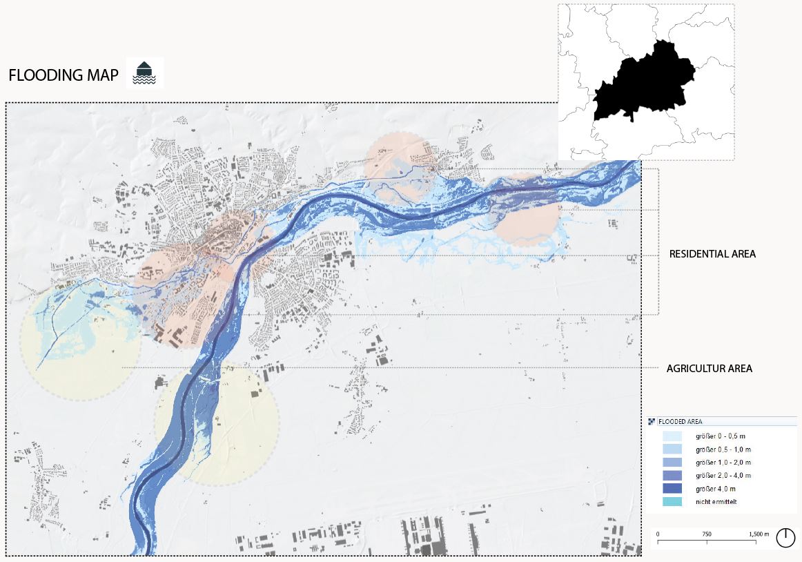
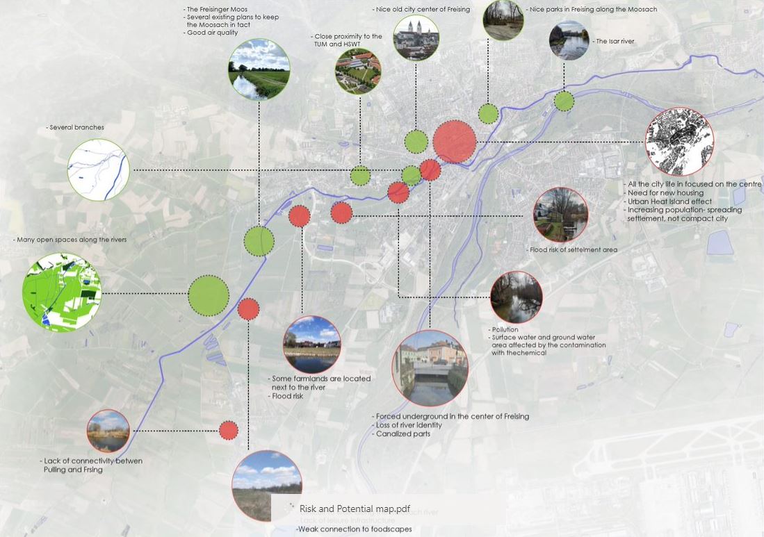
| 07:33, 20 May 2022 | Risk and potential cut-out.jpg (file) |  |
132 KB | 1 | |
| 07:13, 20 May 2022 | Group photo small.jpg (file) |  |
76 KB | 1 | |
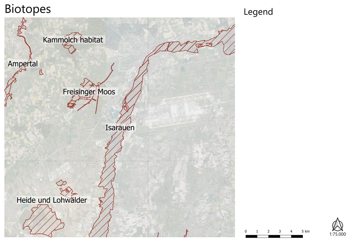
| 12:57, 19 May 2022 | Biotope map cutout.jpg (file) |  |
136 KB | 1 | |
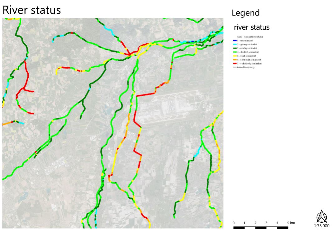
| 12:52, 19 May 2022 | Riverstatus cutout.jpg (file) |  |
101 KB | 1 | |
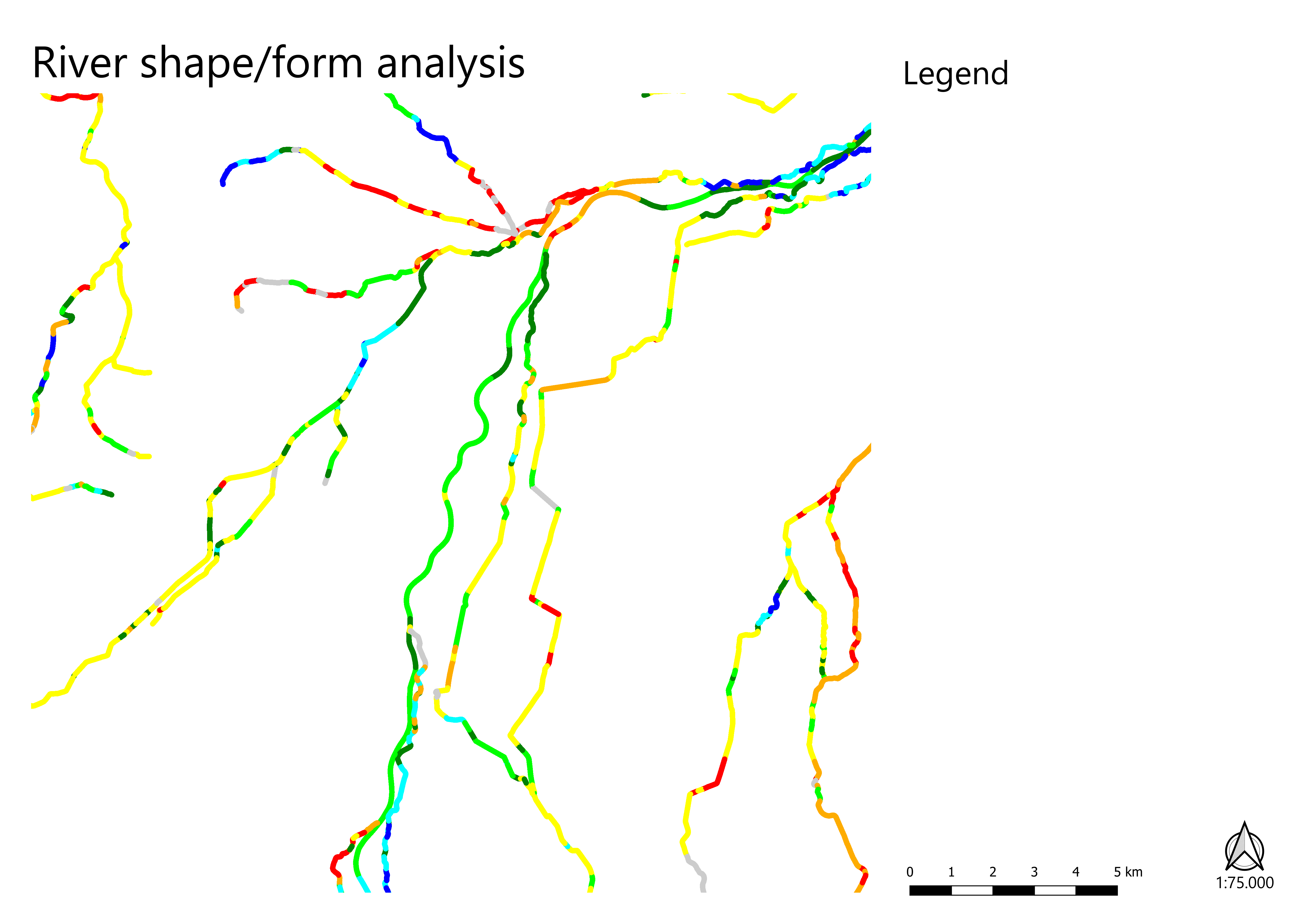
| 12:17, 19 May 2022 | River shape-form map 1to75000.png (file) | Error creating thumbnail: File with dimensions greater than 12.5 MP |
264 KB | 1 |