Unused files
Jump to navigation
Jump to search
The following files exist but are not embedded in any page. Please note that other web sites may link to a file with a direct URL, and so may still be listed here despite being in active use.
Showing below up to 50 results in range #51 to #100.
- Scenarios.JPG 1,027 × 728; 90 KB
- GREEN INFRASTRUCTURE.JPG 695 × 475; 45 KB
- Swot.jpg 964 × 596; 134 KB
- DPSIR Analysis.jpg 1,290 × 714; 224 KB
- Inondations1 Bruxelles.JPG.jpg 1,393 × 889; 150 KB
- The best scenario .jpg 3,508 × 4,394; 911 KB
- 2 View on old factory Joe Port from Sopruse bridge .JPG 4,272 × 2,848; 670 KB
- 2 Combinaison between modern and old architectures.JPG 4,000 × 3,000; 813 KB
- The best scenario.jpg 2,716 × 2,480; 443 KB
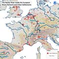
- 210422 Neckar of Europe.jpg 1,573 × 1,573; 1.48 MB
- 210422 maps 04.jpg 978 × 978; 1.47 MB
- 210422 maps 06.jpg 1,291 × 1,291; 1.25 MB
- 210422 maps 09.jpg 1,291 × 1,291; 1.05 MB
- 210422 maps 10.jpg 1,291 × 1,291; 1,016 KB
- 210422 maps 16.jpg 1,291 × 1,291; 1.14 MB
- 210422 maps 18.jpg 1,291 × 1,291; 1.12 MB
- Standwater.jpeg 1,183 × 884; 277 KB
- Upstream Tartu Community 1.jpg 1,620 × 969; 1.24 MB
- SWOT Analysis.jpg 4,000 × 2,250; 1.92 MB
- SWOT Analysis 1.jpg 4,000 × 2,250; 1.89 MB
- Scenario.png 3,508 × 2,480; 785 KB
- Circle tartu analysis.png 1,984 × 1,417; 110 KB
- 1-1.jpg 936 × 662; 196 KB
- 2-2.jpg 936 × 698; 195 KB
- Tollensee.PNG 1,230 × 805; 1.25 MB
- 2-Neubrandenburg Green and blue infrastructure.jpg 2,442 × 1,641; 1.8 MB
- 0002 team 2.jpg 870 × 768; 836 KB
- Photo 2021-05-04 14-15-52.jpg 937 × 1,280; 117 KB
- Sacred spaces map.jpg 3,508 × 2,480; 1.87 MB
- Za landuse nt.jpg 1,323 × 919; 85 KB
- --Historical Maps Showing water way change and growing urbanization--.JPG 1,587 × 1,123; 337 KB
- --Site Image--.jpeg 1,200 × 1,600; 276 KB
- Floodmap Nürtingen.jpg 1,587 × 1,123; 529 KB
- Water bodies.jpg 4,262 × 2,761; 1.77 MB
- Blue infrastructure.png 920 × 713; 360 KB
- Picture5.jpg 1,920 × 969; 130 KB
- Water areas crop.jpg 2,201 × 2,358; 976 KB
- WhatsApp Image 2021-04-22 at 19.35.34.jpeg 1,200 × 1,600; 265 KB
- WaterStreamInPeatlandsFreising.jpeg 768 × 1,024; 196 KB
- Flood prone area.jpg 2,201 × 2,326; 1.05 MB
- Vision compass.jpg 1,300 × 870; 112 KB
- Values .jpg 1,300 × 1,065; 102 KB
- Vision.jpg 1,580 × 821; 662 KB
- Gantt.JPG 883 × 331; 88 KB
- Accessibility map case study template.jpg.jpg 2,000 × 993; 423 KB
- Risks-and-potentials.jpg.jpg 2,025 × 1,115; 459 KB
- Socioeconomic-and-natural-elements.jpg.jpg 2,000 × 1,101; 516 KB
- Landuse map 01.jpg 1,702 × 2,215; 840 KB
- Vector-fish-illustration-1-.jpg 1,160 × 772; 56 KB
- Fish-example.jpg 1,160 × 772; 56 KB


