Unused files
Jump to navigation
Jump to search
The following files exist but are not embedded in any page. Please note that other web sites may link to a file with a direct URL, and so may still be listed here despite being in active use.
Showing below up to 50 results in range #71 to #120.
- Scenario.png 3,508 × 2,480; 785 KB
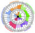
- Circle tartu analysis.png 1,984 × 1,417; 110 KB
- 1-1.jpg 936 × 662; 196 KB
- 2-2.jpg 936 × 698; 195 KB
- Tollensee.PNG 1,230 × 805; 1.25 MB
- 2-Neubrandenburg Green and blue infrastructure.jpg 2,442 × 1,641; 1.8 MB
- 0002 team 2.jpg 870 × 768; 836 KB
- Photo 2021-05-04 14-15-52.jpg 937 × 1,280; 117 KB
- Sacred spaces map.jpg 3,508 × 2,480; 1.87 MB
- Za landuse nt.jpg 1,323 × 919; 85 KB
- --Historical Maps Showing water way change and growing urbanization--.JPG 1,587 × 1,123; 337 KB
- --Site Image--.jpeg 1,200 × 1,600; 276 KB
- Floodmap Nürtingen.jpg 1,587 × 1,123; 529 KB
- Water bodies.jpg 4,262 × 2,761; 1.77 MB
- Blue infrastructure.png 920 × 713; 360 KB
- Picture5.jpg 1,920 × 969; 130 KB
- Water areas crop.jpg 2,201 × 2,358; 976 KB
- WhatsApp Image 2021-04-22 at 19.35.34.jpeg 1,200 × 1,600; 265 KB
- WaterStreamInPeatlandsFreising.jpeg 768 × 1,024; 196 KB
- Flood prone area.jpg 2,201 × 2,326; 1.05 MB
- Vision compass.jpg 1,300 × 870; 112 KB
- Values .jpg 1,300 × 1,065; 102 KB
- Vision.jpg 1,580 × 821; 662 KB
- Gantt.JPG 883 × 331; 88 KB
- Accessibility map case study template.jpg.jpg 2,000 × 993; 423 KB
- Risks-and-potentials.jpg.jpg 2,025 × 1,115; 459 KB
- Socioeconomic-and-natural-elements.jpg.jpg 2,000 × 1,101; 516 KB
- Landuse map 01.jpg 1,702 × 2,215; 840 KB
- Vector-fish-illustration-1-.jpg 1,160 × 772; 56 KB
- Fish-example.jpg 1,160 × 772; 56 KB
- Land-use-map.jpg.jpeg 1,229 × 1,600; 352 KB
- Historical-map-1.jpeg 1,600 × 1,083; 546 KB
- Historical-map-1.jpg.jpeg 1,600 × 1,083; 546 KB
- Recreational Areas.jpg 1,185 × 1,615; 1.31 MB
- Protection Areas.jpg 1,021 × 1,646; 1.35 MB
- Final scenario.jpg 2,291 × 2,073; 1.57 MB
- Cultural space along with Buriganga.png 712 × 333; 583 KB
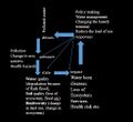
- DPSIR.JPG 492 × 449; 38 KB
- SWOT OF Buriganga.JPG 526 × 228; 26 KB
- Sketch 01.jpg 627 × 857; 1 MB
- Sketch 02.jpg 1,477 × 932; 1.84 MB
- Design Sketchs.jpg 1,423 × 621; 1,002 KB
- Criteria Strategies Actions.jpg 1,774 × 1,674; 994 KB
- Strategies Actions.jpg 1,774 × 1,674; 979 KB
- Criteria.jpg 1,570 × 1,456; 1.13 MB
- Tollense Lake Water System Neubrandenburg-min.jpg 3,508 × 2,480; 1.29 MB
- Tollense Lake Wider Water System in Neubrandenburg.jpeg 3,508 × 2,480; 980 KB
- Map accessibility usability.png 1,102 × 1,227; 773 KB
- Stackholders.jpg.png 1,920 × 956; 84 KB
- Section 1.jpg 6,830 × 1,039; 1.88 MB


