File:Land Use Map.jpg
Jump to navigation
Jump to search

Size of this preview: 800 × 549 pixels. Other resolutions: 2,560 × 1,757 pixels | 4,764 × 3,270 pixels.
Original file (4,764 × 3,270 pixels, file size: 926 KB, MIME type: image/jpeg)
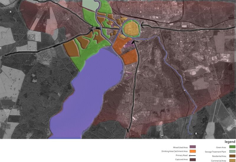
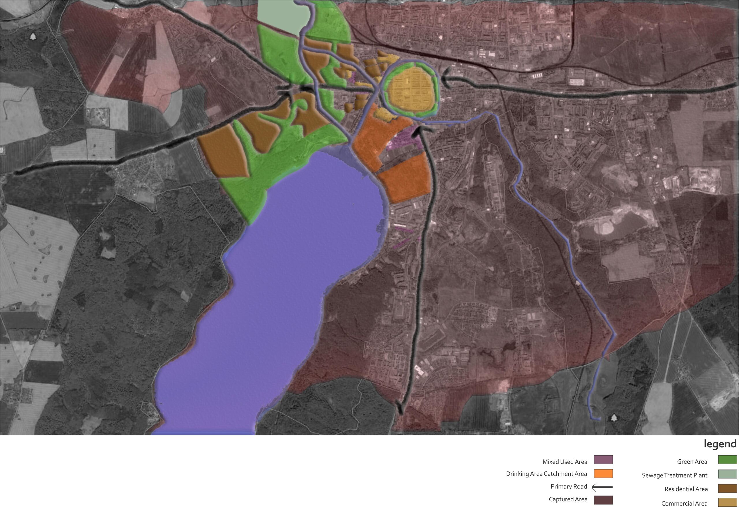
Land Use Map Around Waterbody
File history
Click on a date/time to view the file as it appeared at that time.
| Date/Time | Thumbnail | Dimensions | User | Comment | |
|---|---|---|---|---|---|
| current | 21:34, 24 June 2022 | | 4,764 × 3,270 (926 KB) | Islam.mohammad (talk | contribs) |
You cannot overwrite this file.
File usage
There are no pages that use this file.