Unused files
Jump to navigation
Jump to search
The following files exist but are not embedded in any page. Please note that other web sites may link to a file with a direct URL, and so may still be listed here despite being in active use.
Showing below up to 250 results in range #1 to #250.
- Test.jpg 474 × 296; 28 KB
- Bluehealth toolbox.JPG 987 × 519; 62 KB
- Dummy image case studyGroup 3 template.jpg 750 × 1,334; 439 KB
- Hidro bucuresti.png 1,026 × 1,313; 788 KB
- Pulling Weiher image case study template.jpg 5,174 × 2,910; 1.19 MB
- --Waterscape of Nurtingen.jpg--.jpg 1,653 × 789; 279 KB
- Streams.jpg 960 × 1,280; 223 KB
- Fundeni1.png 1,600 × 1,200; 1.57 MB
- Fundeni 1.png 1,600 × 1,200; 1.57 MB
- Fundeni1 2.jpeg 1,600 × 1,200; 207 KB
- Upstream tartu 2.jpg 685 × 1,024; 136 KB
- Cartography Land use.jpeg 694 × 707; 75 KB
- Historical Cartography.jpeg 716 × 749; 102 KB
- Canal.jpeg 1,200 × 1,600; 196 KB
- Via molo di Baia.jpg 381 × 236; 34 KB
- Group 4 Water Bodies.jpg 3,509 × 2,481; 1.75 MB
- Fusaro lake sacredspace2.JPG 1,259 × 834; 168 KB
- Fusaro Lake sacredspace2 - Copia.JPG 1,259 × 834; 168 KB
- Fusaro Lake 1580.gif 812 × 592; 222 KB
- Urban vs natural landscape 1.jpeg 1,600 × 1,520; 458 KB
- Urban vs natural landscape 2.jpeg 1,599 × 1,600; 1,015 KB
- Piano particolareggiato.jpeg 1,600 × 1,066; 252 KB
- Carta tecnica 65.JPG 1,230 × 838; 167 KB
- Bacoli-lago.jpg 600 × 400; 99 KB
- Porto miseno.jpeg 1,200 × 900; 265 KB
- Camping.JPG 1,437 × 807; 206 KB
- Torregaveta.JPG 1,083 × 809; 140 KB
- Camping2.png 890 × 489; 834 KB
- Acqua morta.JPG 1,035 × 684; 101 KB
- Uploadtest.png 710 × 599; 3 KB
- Amtshaus Neubrandenburg.jpeg 1,280 × 621; 155 KB
- Belvedere Neubrandenburg.jpeg 621 × 1,280; 87 KB
- Neubrandenburg Green and blue infrastructure.JPG 1,203 × 784; 123 KB
- Neubrandenburg Green and blue infrastructure..png 1,173 × 789; 1.34 MB
- Maxresdefault.jpg 1,280 × 720; 270 KB
- 2158797021 46d28792bf.jpg 500 × 341; 83 KB
- WhatsApp Image 2021-04-06 at 3.32.41 PM.jpeg 1,200 × 1,600; 261 KB
- HARTA-TABACARIE-LAKE.png 1,618 × 850; 866 KB
- Complex studentesc lacul tei1.webp 800 × 612; 112 KB
- SGD RISKS.jpg 2,571 × 2,423; 525 KB
- Neubrandenburg 1991.png 2,792 × 1,450; 1.66 MB
- Neubrandenburg 1953.png 2,794 × 1,458; 1.68 MB
- Immagine3.jpg 780 × 298; 57 KB
- Immagine4.jpg 665 × 351; 48 KB
- Water accessibility.jpg 2,480 × 3,508; 1.35 MB
- Commap.png 960 × 605; 281 KB
- Fusaro.community.mapping.JPG 1,251 × 728; 87 KB
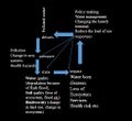
- DPSIR.png 1,048 × 1,032; 211 KB
- Fusaro Lake scenario 1.png 623 × 468; 345 KB
- Fusaro Lake scenario1.png 600 × 450; 316 KB
- Scenarios.JPG 1,027 × 728; 90 KB
- GREEN INFRASTRUCTURE.JPG 695 × 475; 45 KB
- Swot.jpg 964 × 596; 134 KB
- DPSIR Analysis.jpg 1,290 × 714; 224 KB
- Inondations1 Bruxelles.JPG.jpg 1,393 × 889; 150 KB
- The best scenario .jpg 3,508 × 4,394; 911 KB
- 2 View on old factory Joe Port from Sopruse bridge .JPG 4,272 × 2,848; 670 KB
- 2 Combinaison between modern and old architectures.JPG 4,000 × 3,000; 813 KB
- The best scenario.jpg 2,716 × 2,480; 443 KB
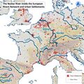
- 210422 Neckar of Europe.jpg 1,573 × 1,573; 1.48 MB
- 210422 maps 04.jpg 978 × 978; 1.47 MB
- 210422 maps 06.jpg 1,291 × 1,291; 1.25 MB
- 210422 maps 09.jpg 1,291 × 1,291; 1.05 MB
- 210422 maps 10.jpg 1,291 × 1,291; 1,016 KB
- 210422 maps 16.jpg 1,291 × 1,291; 1.14 MB
- 210422 maps 18.jpg 1,291 × 1,291; 1.12 MB
- Standwater.jpeg 1,183 × 884; 277 KB
- Upstream Tartu Community 1.jpg 1,620 × 969; 1.24 MB
- SWOT Analysis.jpg 4,000 × 2,250; 1.92 MB
- SWOT Analysis 1.jpg 4,000 × 2,250; 1.89 MB
- Scenario.png 3,508 × 2,480; 785 KB
- Circle tartu analysis.png 1,984 × 1,417; 110 KB
- 1-1.jpg 936 × 662; 196 KB
- 2-2.jpg 936 × 698; 195 KB
- Tollensee.PNG 1,230 × 805; 1.25 MB
- 2-Neubrandenburg Green and blue infrastructure.jpg 2,442 × 1,641; 1.8 MB
- 0002 team 2.jpg 870 × 768; 836 KB
- Photo 2021-05-04 14-15-52.jpg 937 × 1,280; 117 KB
- Sacred spaces map.jpg 3,508 × 2,480; 1.87 MB
- Za landuse nt.jpg 1,323 × 919; 85 KB
- --Historical Maps Showing water way change and growing urbanization--.JPG 1,587 × 1,123; 337 KB
- --Site Image--.jpeg 1,200 × 1,600; 276 KB
- Floodmap Nürtingen.jpg 1,587 × 1,123; 529 KB
- Water bodies.jpg 4,262 × 2,761; 1.77 MB
- Blue infrastructure.png 920 × 713; 360 KB
- Picture5.jpg 1,920 × 969; 130 KB
- Water areas crop.jpg 2,201 × 2,358; 976 KB
- WhatsApp Image 2021-04-22 at 19.35.34.jpeg 1,200 × 1,600; 265 KB
- WaterStreamInPeatlandsFreising.jpeg 768 × 1,024; 196 KB
- Flood prone area.jpg 2,201 × 2,326; 1.05 MB
- Vision compass.jpg 1,300 × 870; 112 KB
- Values .jpg 1,300 × 1,065; 102 KB
- Vision.jpg 1,580 × 821; 662 KB
- Gantt.JPG 883 × 331; 88 KB
- Accessibility map case study template.jpg.jpg 2,000 × 993; 423 KB
- Risks-and-potentials.jpg.jpg 2,025 × 1,115; 459 KB
- Socioeconomic-and-natural-elements.jpg.jpg 2,000 × 1,101; 516 KB
- Landuse map 01.jpg 1,702 × 2,215; 840 KB
- Vector-fish-illustration-1-.jpg 1,160 × 772; 56 KB
- Fish-example.jpg 1,160 × 772; 56 KB
- Land-use-map.jpg.jpeg 1,229 × 1,600; 352 KB
- Historical-map-1.jpeg 1,600 × 1,083; 546 KB
- Historical-map-1.jpg.jpeg 1,600 × 1,083; 546 KB
- Recreational Areas.jpg 1,185 × 1,615; 1.31 MB
- Protection Areas.jpg 1,021 × 1,646; 1.35 MB
- Final scenario.jpg 2,291 × 2,073; 1.57 MB
- Cultural space along with Buriganga.png 712 × 333; 583 KB
- DPSIR.JPG 492 × 449; 38 KB
- SWOT OF Buriganga.JPG 526 × 228; 26 KB
- Sketch 01.jpg 627 × 857; 1 MB
- Sketch 02.jpg 1,477 × 932; 1.84 MB
- Design Sketchs.jpg 1,423 × 621; 1,002 KB
- Criteria Strategies Actions.jpg 1,774 × 1,674; 994 KB
- Strategies Actions.jpg 1,774 × 1,674; 979 KB
- Criteria.jpg 1,570 × 1,456; 1.13 MB
- Tollense Lake Water System Neubrandenburg-min.jpg 3,508 × 2,480; 1.29 MB
- Tollense Lake Wider Water System in Neubrandenburg.jpeg 3,508 × 2,480; 980 KB
- Map accessibility usability.png 1,102 × 1,227; 773 KB
- Stackholders.jpg.png 1,920 × 956; 84 KB
- Section 1.jpg 6,830 × 1,039; 1.88 MB
- Section 2.jpg 4,972 × 1,039; 1.51 MB
- Section 3.jpg 5,126 × 998; 1.85 MB
- VISION FUSAROLAKE.JPG 606 × 885; 95 KB
- FUSAROLAKE spatial translaton vision.JPG 606 × 885; 95 KB
- The lake and the people.JPG 651 × 464; 79 KB
- 36e9d16b-98ea-4858-9515-ec097e87d183.jpg 621 × 1,280; 192 KB
- SiutghiolPheasant.jpeg 900 × 1,600; 200 KB
- Stackeholdermap2020.png 900 × 787; 1.21 MB
- Stackeholdermap 2020.png 900 × 787; 1.21 MB
- Stackeholdermap 2007.png 900 × 787; 1.15 MB
- SiutghiolFrog.jpeg 1,114 × 1,600; 119 KB
- Sylvensteinspeicher-Isar-4943034 1920.jpg 1,920 × 1,280; 782 KB
- Wiki1.JPG 453 × 850; 59 KB
- Image3.png 904 × 827; 97 KB
- Plumbuita Monastery.png 821 × 674; 1.08 MB
- Group.png 1,836 × 988; 959 KB
- Process with TimePeatlands.JPG 754 × 452; 43 KB
- MicrosoftTeams-image (14)c.jpg 488 × 443; 127 KB
- Circles FusaroLake.png 746 × 470; 38 KB
- Error creating thumbnail: File with dimensions greater than 12.5 MPUrbanTransect Fusaro.png 4,961 × 3,508; 1.74 MB
- Error creating thumbnail: File with dimensions greater than 12.5 MPUrban Transect Fusaro.png 4,961 × 3,508; 1.74 MB
- OvidiusParkSiutghiol1.jpeg 1,200 × 1,600; 332 KB
- Social groups.png 3,507 × 2,480; 1.16 MB
- 31.jpg 4,000 × 2,250; 1.21 MB
- Community Pressures.jpg 252 × 173; 33 KB
- Schema community mapping4.jpg 1,052 × 994; 1.98 MB
- 03team02m.jpg 1,240 × 1,145; 1.57 MB
- Transect G.jpg 917 × 688; 77 KB
- Transect B.jpg 6,000 × 4,500; 1.5 MB
- Transect B Buriganga revised.jpg 6,000 × 4,500; 1.44 MB
- Dhaka City across Buriganga River in a 1861 painting 2.jpg 1,250 × 365; 71 KB
- Powermappingteam2.png 646 × 428; 124 KB
- Stakeholdersneedsteam2.jpg 3,508 × 2,480; 677 KB
- G2S2.jpg 1,496 × 2,066; 257 KB
- G2S3.jpg 1,496 × 2,066; 270 KB
- FRONTCOVER.jpeg 948 × 1,600; 412 KB
- FRONTCOVER5.jpeg 2,480 × 3,509; 1.86 MB
- FRONTCOVER6.jpg 2,480 × 3,190; 1.72 MB
- Goal.JPG 1,280 × 720; 142 KB
- Prezentare Fundeni possible futures.jpg 960 × 540; 89 KB
- Prezentare Fundeni idkexactly.jpg 960 × 540; 85 KB
- SCENARIO.jpg 1,280 × 720; 96 KB
- Land use map.jpg 2,762 × 2,387; 1.59 MB
- People.jpg 2,882 × 2,219; 720 KB
- Map 3.jpeg 2,882 × 2,219; 720 KB
- Zone.jpg 2,892 × 2,260; 715 KB
- Screen Shot 2021-06-14 at 5.37.06 PM.png 2,560 × 1,600; 1.37 MB
- DPSIR1.jpg 4,821 × 2,491; 514 KB
- DPSIR2.jpg 4,821 × 2,491; 506 KB
- DPSIR3.jpg 4,821 × 2,491; 418 KB
- Water2.jpg 3,123 × 1,909; 426 KB
- Tt.jpg 1,280 × 720; 110 KB
- Section1.jpg 8,781 × 2,106; 1.6 MB
- Section2.jpg 2,902 × 1,225; 471 KB
- WAVE Team Neubrandenburg-min.jpg 3,508 × 2,480; 696 KB
- Bank of the lake.jpg 1,024 × 768; 459 KB
- Eeeee.JPG 662 × 489; 63 KB
- Narratve scenario.jpg 512 × 309; 39 KB
- 1-s2.0-S2095263520300868-gr1.jpg 580 × 410; 71 KB
- Green blue infra.jpg 815 × 576; 178 KB
- Wave nuertingen labtalks 4.JPG 1,200 × 802; 728 KB
- Wave nuertingen labtalks 7.JPG 1,200 × 802; 770 KB
- Screenshot (786).png 1,920 × 1,080; 1.1 MB
- MAPPA CAMPI FLEGREI.jpg 2,086 × 1,884; 1.01 MB
- My maps.png 1,920 × 1,080; 1.1 MB
- Campi flegrei mappa.jpg 2,086 × 1,884; 1.01 MB
- Castello-di-baia-3.jpg 1,920 × 1,080; 196 KB
- Anfiteatro e paesaggio.jpg 560 × 315; 47 KB
- Castello-di-Baia-Museo-archeologico-dei-Campi-Flegrei.jpg 400 × 300; 147 KB
- Grivita.jpg 527 × 562; 149 KB
- Key Image Lake Miseno.jpeg 2,016 × 1,134; 412 KB
- Key Lake Miseno 400px.jpg 400 × 225; 113 KB
- Fondi di baia.jpg 1,920 × 1,080; 196 KB
- Fondi di baia.jpeg 1,920 × 1,080; 196 KB
- Infrastrutture verdi blu.jpg 675 × 442; 78 KB
- BOTTLES ON THE WATER.jpeg 1,109 × 1,478; 315 KB
- Businesses.png 608 × 430; 167 KB
- FLOWER BED IN THE RIVER-min.jpeg 4,032 × 3,024; 1.76 MB
- RIVER EXTENT.jpg 1,637 × 1,157; 322 KB
- RIVER EXTENT page-0001-min.jpg 3,093 × 1,595; 708 KB
- Emajõgi, 1913..jpg 595 × 400; 47 KB
- HALF WILD.jpg 3,024 × 4,032; 1.78 MB
- River in the Downtown area.jpg 3,024 × 4,032; 1.48 MB
- Urbanizing the wild area.jpg 4,032 × 3,024; 1.79 MB
- F4 Protection.png 1,487 × 1,240; 1.34 MB
- Index.php?title=File-Index.php?title=File-.jpg 783 × 523; 163 KB
- Blue Green2.png 1,975 × 1,653; 1.3 MB
- Businesses2.png 557 × 469; 192 KB
- Waterstructure.png 682 × 384; 202 KB
- 1.1.jpg 1,280 × 720; 92 KB
- 045864 ERM Fk2821 88 pisipilt.jpg 799 × 501; 87 KB
- Wave timeline.jpg 2,430 × 3,234; 1.34 MB
- Kalda typo WIKI.png 3,508 × 2,480; 698 KB
- Kallas.png 3,508 × 2,480; 698 KB
- USES and COMMUnity.jpg 1,920 × 1,358; 464 KB
- Emajogi timeline.jpeg 2,430 × 3,234; 1.34 MB
- Pilt1 (1).jpg 1,920 × 1,440; 1.91 MB
- Pilt1 (2).jpg 1,920 × 1,440; 1.79 MB
- UEberflutungsflaechen 2022-04-29.png 1,123 × 1,587; 1.19 MB
- UEberflutungsflaechen 2022-04-29(1).png 1,123 × 1,587; 931 KB
- 1637-3.jpg 711 × 485; 162 KB
- Jänese.jpg 743 × 469; 102 KB
- 1est.jpg 369 × 769; 61 KB
- Landuse Emajõgi.jpg 4,812 × 3,083; 1.87 MB
- Index.php?title=File-Yourcase landuse1.jpg 4,812 × 3,083; 1.87 MB
- Decentralization.jpg 2,339 × 1,283; 207 KB
- Road as a barrirer.jpg 458 × 644; 48 KB
- Accessibility.jpg 672 × 629; 42 KB
- Accessibility2.jpg 2,048 × 740; 94 KB
- Lynch Approach Emajõgi.jpg 1,857 × 2,227; 273 KB
- Dorpat Tartu.jpg 2,914 × 2,164; 1.61 MB
- Dorpat 1480 1682.png 1,366 × 768; 1.55 MB
- Error creating thumbnail: File with dimensions greater than 12.5 MP1.3-Worst Scenario.png 4,584 × 5,301; 981 KB
- 1.3-Worst Scenario.jpg 1,600 × 1,223; 333 KB
- Error creating thumbnail: File with dimensions greater than 12.5 MP1.3- Worst Scenario.png 4,584 × 5,301; 981 KB
- Water region cultural and geographical typologies patterns in space.png 1,282 × 856; 1.65 MB
- WAVE Living Lab Neubrandenburg 2022.jpg 1,280 × 720; 88 KB
- Water areas- Settlements, Infrastructure ,Agriculture.png 1,278 × 854; 1.89 MB
- 122121.jpg 773 × 721; 270 KB
- Belvedere-neubrandenburg.jpg 1,170 × 658; 203 KB
- PHOTOSHOP MAPS TOLLENCE RIVER 2.jpg 1,282 × 856; 228 KB
- 2.jpg 395 × 773; 77 KB
- 3.jpg 401 × 785; 95 KB
- 4.jpg 405 × 789; 119 KB
- 5.jpg 551 × 733; 66 KB
- Kaltluft.jpg 1,380 × 990; 146 KB
- Natureprotection areas.jpg 1,624 × 1,196; 517 KB
- 10037510 1 articledetail 270-0008-8251528-hin103-2003-hafen-hameln-mafi.jpg 1,004 × 600; 217 KB
- Szenarios page-0001.jpg 2,000 × 1,125; 922 KB


