WAVE Living Lab in Nürtingen, Germany: Difference between revisions
No edit summary |
No edit summary |
||
| (33 intermediate revisions by the same user not shown) | |||
| Line 1: | Line 1: | ||
{{# | {{#ev:youtube| | ||
|alignment=inline | id=5pDZIBXyF7k|alignment=inline |dimensions=400 |description= A drone flight over the river Neckar in Nürtingen prepared by the IMLA WAVE project team Gabriel, Yana, Digjam, Titiksha, Manasviben}} | ||
|dimensions=400 | |||
|description= | |||
{{# | {{#ev:youtube| | ||
|alignment=inline | id=_S2XYMM1C4c |alignment=inline |dimensions=400 |description= Dr. Ellen Fetzer explains the concept of green infrastructure on the example of the river Neckar and the fish pass}} | ||
|dimensions=400 | |||
|description= | |||
== The Nürtingen WAVE Living Lab == | |||
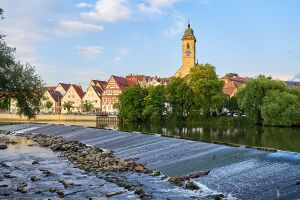
| | [[File:Nuertingen hlab header.jpg|thumb|right|300px|Water landscapes on the river Neckar in Nürtingen, Germany]] | ||
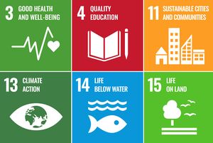
| | [[File:WAVE SDGs.jpg|thumb|right|300px|WAVE Living Labs aim at addressing several Sustainable Development Goals in an integrated way]] | ||
Nürtingen is part of Greater Stuttgart Region in the southwest of Germany. Greater Stuttgart Region comprises 179 municipalities in a polycentric structure around the urban centres of Stuttgart, Ludwigsburg, Esslingen and Böblingen. The regional economy is very strong and provides numerous high-skilled jobs, especially in the production of the region’s emblematic cars and sophisticated machines. | |||
As a consequence, people from other areas of Baden-Württemberg, the rest of Germany, Europe and the entire world are attracted by the prospect of finding a well-paid job in the regional economy. But the economic success of the urban centres in the Stuttgart region creates high pressures on scarce resources. Both the expanding industry and the housing needs of a rising population require space. The region’s average density of around 720 inhabitants/km² is already high and bound to increase. With a lenght of 362 kilometres Neckar River is a major landscape element in the southwest of Germany with a long history of settlement and cultural identities. | |||
In this socio-economic context, the water areas of Nürtingen play a significant role for sustainable development. The city is not only located at the river Neckar, it also includes some important tributaries: Steinach, Aich and Tiefenbach. Altogether, these water bodies form the local catchment area that also constitutes the flood risk areas and potential ecogical corridors. Urbanisation of the past centuries has seen a profound transformation of the local riverscapes. Accessibility is difficult or impossible in many areas and also the ecological quality is challenged. | |||
The Nürtingen Living Lab has therefore the following objectives: | |||
*Generate knowledge about the local water areas, their system context, challenges and opportuntities | |||
*To address these topics in project-based learning settings offered by Nürtingen-Geislingen University | |||
*To include local stakeholders and citizens in this knowledge creation process | |||
*To generate and communicate alternative futures for the river landscapes | |||
*To contribute this way to various SDGs, in particular 'Sustainable Cities and Communities', 'Life on Land', Life under Water' and 'Quality Education' | |||
== Impressions from our rivers == | |||
<gallery caption=" " widths="200px" heights="150px" perrow="5"> | |||
File:Neckar people river.JPG|People appreciate informal access to the river | |||
File:Highwater neckar.JPG|High water levels are frequent on the river Neckar because of its broad catchment area | |||
File:Swans Steinach.JPG|Swans and other water birds can frequently be observed in the middle of the city, very much appreciated by citizens | |||
File:Steinach Neckar.JPG|the mouth of river Steinach into Neckar is a very iconic and popular urban landscape element | |||
File:Steinach Walkway.JPG|Steinach is a tributary to the Neckar and only partially accessible | |||
File:Steinach river.JPG|Steinach is a hidden treasure at neighbourhood level | |||
File:Steinach informaluses.JPG|further upstream, people in high density housing love to use the river areas in informal ways | |||
File:Steinach Bridge.JPG|Steinach is a place for nature in the city | |||
</gallery> | |||
== Location and scope == | |||
* The Area of study is Nuertingen represented with the maps below. | |||
{{#display_map: 48.627172, 9.337342 ~ Nürtingen-Geislingen University of Applied Science | |||
}} | |||
== WAVE Living Lab Projects 2021 - Nürtingen Waterscapes == | == WAVE Living Lab Projects 2021 - Nürtingen Waterscapes == | ||
| Line 21: | Line 48: | ||
=== [[WAVE Team 5 Nuertingen 2021|Wave Team 5 Nürtingen 2021]] === | === [[WAVE Team 5 Nuertingen 2021|Wave Team 5 Nürtingen 2021]] === | ||
=== [[WAVE Team 6 Nuertingen 2021|Wave Team 6 Nürtingen 2021]] === | === [[WAVE Team 6 Nuertingen 2021|Wave Team 6 Nürtingen 2021]] === | ||
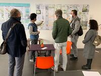
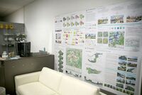
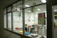
== Living Lab Activties in 2021 - Citizens workshop, interventions and exhibition == | |||
<gallery caption=" " widths="200px" heights="150px" perrow="5"> | |||
File:Wave nuertingen mapping 6.JPG | |||
File:Wave nuertingen mapping 5.JPG | |||
File:Wave nuertingen mapping 4.JPG | |||
File:Wave nuertingen mapping 3.JPG | |||
File:Wave nuertingen mapping.JPG | |||
File:Wave nuertingen labtalks 6.JPG | |||
File:Wave nuertingen labtalks 5.JPG | |||
File:Wave nuertingen labtalks 3.JPG | |||
File:Wave nuertingen labtalks 2.JPG | |||
File:Wave nuertingen labtalks 1.JPG | |||
File:Wave nuertingen labsetting2.JPG | |||
File:Wave nuertingen labsetting.JPG | |||
File:Wave lab nuertingen.JPG | |||
File:FLussquizz wavelab.JPG | |||
File:Wave exhibition Oct 5.jpg | |||
File:Wave exhibition Oct 4.jpg | |||
File:Wave exhibition Oct 3.JPG | |||
File:Wave exhibition Oct 2.JPG | |||
File:Wave exhibition Oct.JPG | |||
</gallery> | |||
== Understanding the water landscape: Weblinks, Maps and Geodata == | |||
*[http://webgis.region-stuttgart.org/Web/regionalplan Regional Plan of Greater Stuttgart Region and Regional Plan] | |||
*[https://www.region-stuttgart.org/landschaftspark/ueber-den-landschaftspark Landscape Park Stuttgart Region] | |||
*[https://udo.lubw.baden-wuerttemberg.de All environmental data maps of Baden-Württemberg, including water areas] | |||
*[https://www.leo-bw.de/themen/historische-flurkarten|Historical land use maps of Baden-Württemberg]] | |||
*[https://udo.lubw.baden-wuerttemberg.de/projekte/ EU Water Framework Directive: Documentation of structural measures on rivers in Baden-Württemberg] | |||
*EU Floods Directive - Flood and Flood Risk Mapping in Baden-Württemberg: | |||
**https://www.hochwasser.baden-wuerttemberg.de | |||
**https://www.hochwasser.baden-wuerttemberg.de/hochwasserrisikokarten | |||
*[https://www.hochwasserschutz-nuertingen.de City of Nürtingen Floods Protection Website] | |||
*[https://menschen-am-neckar.de/ People on the river Neckar: a mapping project supporte by the House of History] | |||
==WAVE ERASMUS Project == | |||
[[File:Eu funded logo.jpg|thumb|none|300px|The WAVE Project has been (partially) funded by the ERASMUS+ grant program of the European Union under grant no. 2020-1-RO01-KA203-080122. Neither the European Commission nor the project's national funding agency are responsible for the content or liable for any losses or damage resulting of the use of these resources.]] | |||
Latest revision as of 08:27, 7 June 2023
The Nürtingen WAVE Living Lab
Nürtingen is part of Greater Stuttgart Region in the southwest of Germany. Greater Stuttgart Region comprises 179 municipalities in a polycentric structure around the urban centres of Stuttgart, Ludwigsburg, Esslingen and Böblingen. The regional economy is very strong and provides numerous high-skilled jobs, especially in the production of the region’s emblematic cars and sophisticated machines.
As a consequence, people from other areas of Baden-Württemberg, the rest of Germany, Europe and the entire world are attracted by the prospect of finding a well-paid job in the regional economy. But the economic success of the urban centres in the Stuttgart region creates high pressures on scarce resources. Both the expanding industry and the housing needs of a rising population require space. The region’s average density of around 720 inhabitants/km² is already high and bound to increase. With a lenght of 362 kilometres Neckar River is a major landscape element in the southwest of Germany with a long history of settlement and cultural identities.
In this socio-economic context, the water areas of Nürtingen play a significant role for sustainable development. The city is not only located at the river Neckar, it also includes some important tributaries: Steinach, Aich and Tiefenbach. Altogether, these water bodies form the local catchment area that also constitutes the flood risk areas and potential ecogical corridors. Urbanisation of the past centuries has seen a profound transformation of the local riverscapes. Accessibility is difficult or impossible in many areas and also the ecological quality is challenged.
The Nürtingen Living Lab has therefore the following objectives:
- Generate knowledge about the local water areas, their system context, challenges and opportuntities
- To address these topics in project-based learning settings offered by Nürtingen-Geislingen University
- To include local stakeholders and citizens in this knowledge creation process
- To generate and communicate alternative futures for the river landscapes
- To contribute this way to various SDGs, in particular 'Sustainable Cities and Communities', 'Life on Land', Life under Water' and 'Quality Education'
Impressions from our rivers
Location and scope
- The Area of study is Nuertingen represented with the maps below.
WAVE Living Lab Projects 2021 - Nürtingen Waterscapes
Wave Team 1 Nürtingen 2021
Wave Team 2 Nürtingen 2021
Wave Team 3 Nürtingen 2021
Wave Team 4 Nürtingen 2021
Wave Team 5 Nürtingen 2021
Wave Team 6 Nürtingen 2021
Living Lab Activties in 2021 - Citizens workshop, interventions and exhibition
Understanding the water landscape: Weblinks, Maps and Geodata
- Regional Plan of Greater Stuttgart Region and Regional Plan
- Landscape Park Stuttgart Region
- All environmental data maps of Baden-Württemberg, including water areas
- land use maps of Baden-Württemberg]
- EU Water Framework Directive: Documentation of structural measures on rivers in Baden-Württemberg
- EU Floods Directive - Flood and Flood Risk Mapping in Baden-Württemberg:
- City of Nürtingen Floods Protection Website
- People on the river Neckar: a mapping project supporte by the House of History
WAVE ERASMUS Project

