Uploads by Cecile.agustoni
Jump to navigation
Jump to search
This special page shows all uploaded files.
| Date | Name | Thumbnail | Size | Description | Versions |
|---|---|---|---|---|---|
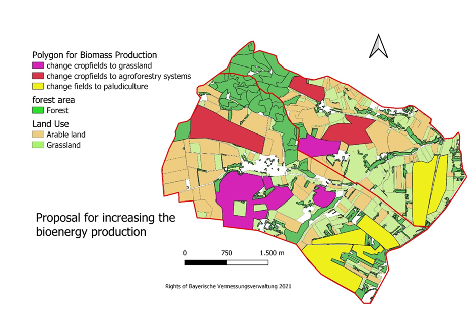
| 16:28, 21 May 2022 | 6.2.png (file) |  |
519 KB | Proposed land use changes for energy production in the project area - Author: CCM students 2022 | 1 |
| 16:26, 21 May 2022 | 6.1.png (file) |  |
70 KB | Proposed land use changes for energy production in the project area - Author: CCM students 2022 | 1 |
| 20:50, 19 May 2022 | 5.5 Map of energy potential in project area (authors CCM stuents, 2022)..png (file) | ..png) |
152 KB | 1 | |
| 20:50, 19 May 2022 | 5.4 Transformation of intensive agriculture to extensive mixed agriculture (author Rok Brišnik, 2022, source Euractiv, 2022)..png (file) | ..png) |
671 KB | 1 | |
| 20:49, 19 May 2022 | 5.3 Construction of a trim track along the already existing infrastructure. Points with exercise aids would need to be constructed.png (file) |  |
1.59 MB | 1 | |
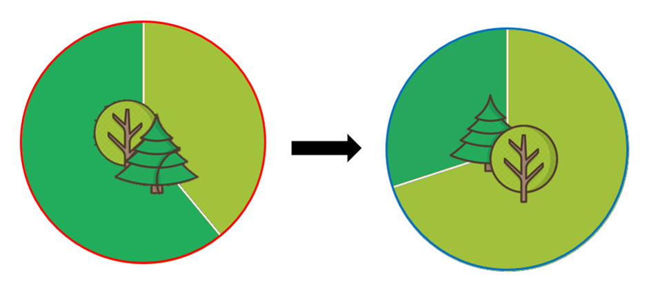
| 20:49, 19 May 2022 | 5.2 Forest structure transformation.png (file) |  |
124 KB | 1 | |
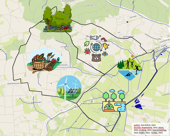
| 20:48, 19 May 2022 | 5.1 Areas for green transformation (author Rok Brišnik, 2022).png (file) | .png) |
701 KB | 1 | |
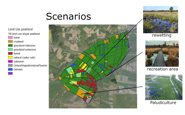
| 20:22, 19 May 2022 | 4.4 Scenarios.png (file) |  |
342 KB | Graph - Scenario by Pia Röder Picture sources: recreation picture source: fotocommunity 17.05.22 Steg im Moor: halali magazin 01/2021 Rewetting: Marisa04, pixabay.com (2022) | 1 |
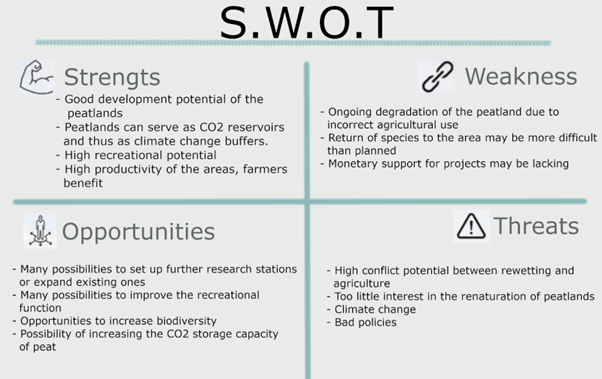
| 20:21, 19 May 2022 | 4.3 SWOT.png (file) |  |
105 KB | 1 | |
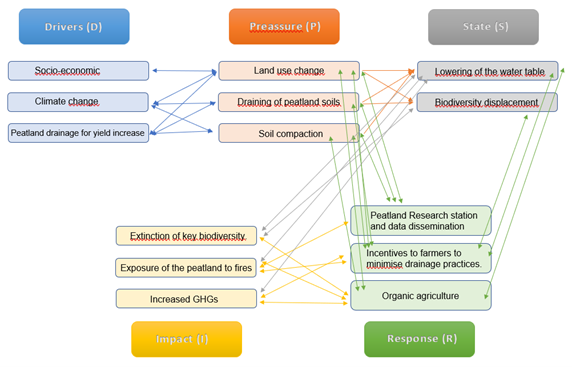
| 20:21, 19 May 2022 | 4.2 Graph.png (file) |  |
90 KB | 1 | |
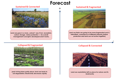
| 20:09, 19 May 2022 | 4.1 Forecast - Pia Röder and Juan Miguel Ovalle.png (file) |  |
160 KB | Forecast - Pia Röder and Juan Miguel Ovalle Picture Sources: upper left: Marisa04, pixabay.com (2022) upper right: - lower left: Ludger Frye 2012 (NABU) lower right: Christian Fischer 31. Dezember 1986 (Wikipedia) | 1 |
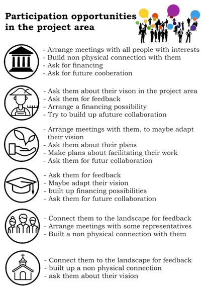
| 20:08, 19 May 2022 | 3.6 participation opportunity in the project area.png (file) |  |
106 KB | 1 | |
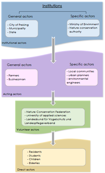
| 20:07, 19 May 2022 | 3.5 Institutions.png (file) |  |
104 KB | 1 | |
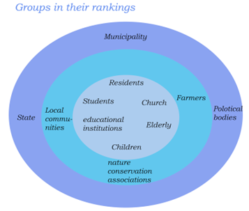
| 20:07, 19 May 2022 | 3.4 graph groups in their rankings.png (file) |  |
41 KB | 1 | |
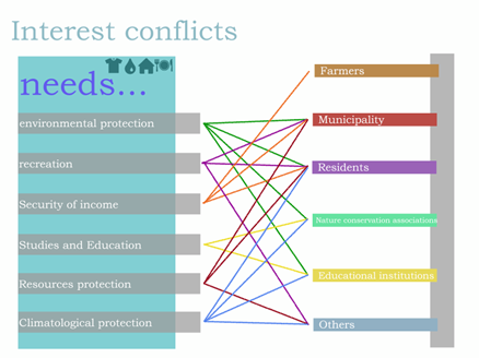
| 20:07, 19 May 2022 | 3.3 graph Interest conflicts.png (file) |  |
61 KB | 1 | |
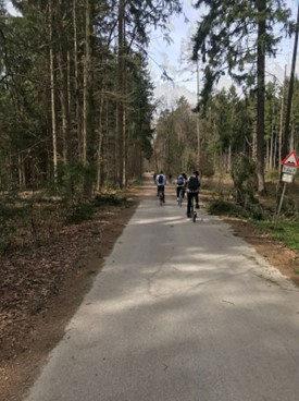
| 20:06, 19 May 2022 | 3.2 Climate change master students in the project area.jpg (file) |  |
35 KB | 1 | |
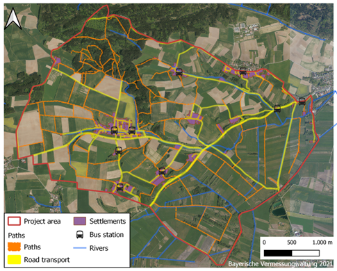
| 20:06, 19 May 2022 | 3.1 Map Road transport and path map.png (file) |  |
468 KB | Map_Road_transport_and_path | 1 |
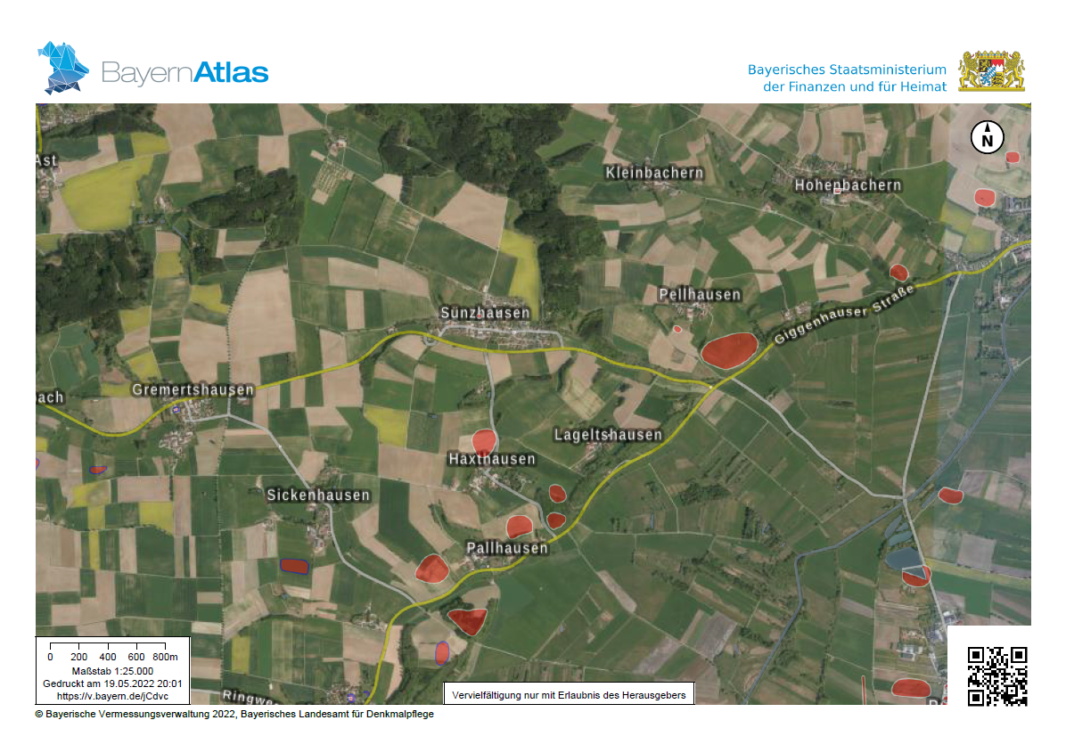
| 18:03, 19 May 2022 | 2.13 Map Denkmäler.PNG (file) |  |
1.82 MB | BayernAtlas Denkmäler | 1 |
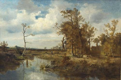
| 17:52, 19 May 2022 | Fritz Halberg-Krauss, Holzfäller im Freisinger Moos 1942.png (file) |  |
266 KB | 1 | |
| 17:52, 19 May 2022 | 2.11 contemporary memorials of Christians and testify to the historical settlement of Christianity in Freising.jpg (file) |  |
15 KB | 1 | |
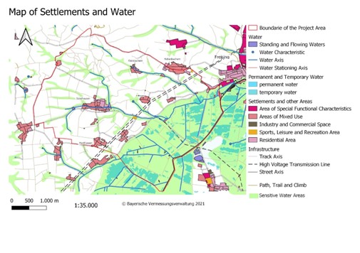
| 17:51, 19 May 2022 | 2.12 Map settlements and water.jpg (file) |  |
55 KB | 1 | |
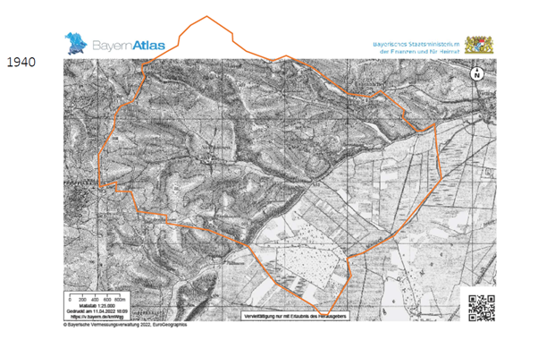
| 17:42, 19 May 2022 | 2.10 Situation on the area around 1940 BayernAtlas.png (file) |  |
233 KB | 1 | |
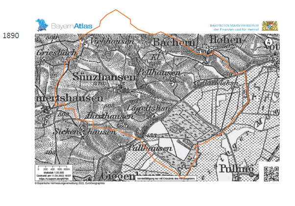
| 17:42, 19 May 2022 | 2.9 Situation on the area around 1890 BayernAtlas.png (file) |  |
256 KB | 1 | |
| 17:41, 19 May 2022 | 2.8 The Hills were used mostly for agriculture on the sides and Woodlands on top MapBayernAtlas.png (file) |  |
151 KB | 1 | |
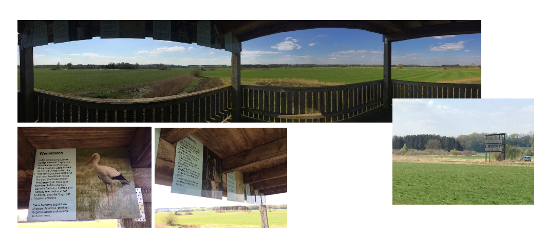
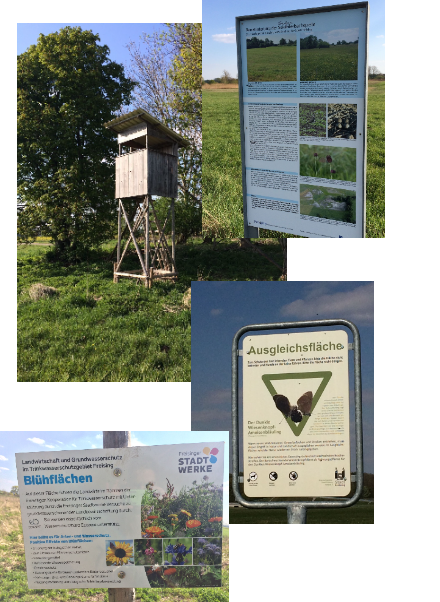
| 17:33, 19 May 2022 | 2.7 Touristic use of the moos.PNG (file) |  |
796 KB | Touristic view facility gives a wide overview of the area and informs the people about the nature protection measures and endangered species | 1 |
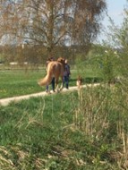
| 17:33, 19 May 2022 | 2.6 Freisinger moos- recreation area.jpg (file) |  |
12 KB | The peatland is also an important recreation area for the Freisinger inhabitants | 1 |
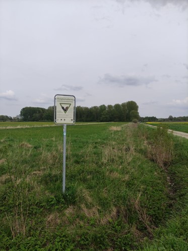
| 17:04, 19 May 2022 | Protected grassland to preserve butterflies in Freisinger Moos.jpg (file) |  |
45 KB | Picture: Protected grassland to preserve butterflies in Freisinger Moos (author: Rok Brišnik, 2022). | 1 |
| 16:58, 19 May 2022 | 1.6.png (file) |  |
1 KB | 2 | |
| 19:44, 14 May 2022 | 1.4.png (file) |  |
1 KB | 2 | |
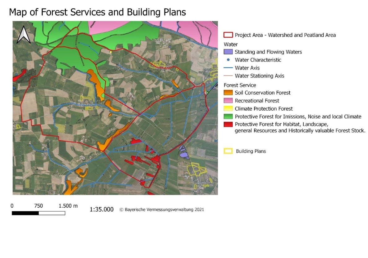
| 19:10, 14 May 2022 | Map of Forest Services and building plans.jpg (file) |  |
174 KB | 1 | |
| 19:10, 14 May 2022 | 2.4 Map of agricultural land use.jpg (file) |  |
178 KB | 1 | |
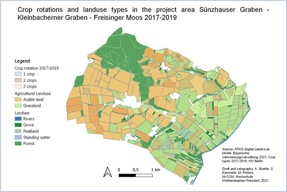
| 19:10, 14 May 2022 | 1.10 Crop rotation.png (file) |  |
233 KB | 1 | |
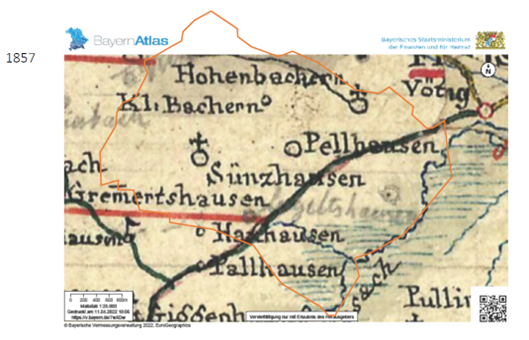
| 19:09, 14 May 2022 | 2.3 Map of the area in 1857.png (file) |  |
352 KB | 1 | |
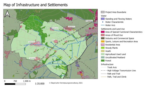
| 19:09, 14 May 2022 | 2.2 Infrastructure and settlements.jpg (file) |  |
48 KB | 1 | |
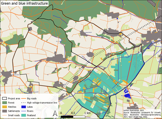
| 19:09, 14 May 2022 | 1.11 Green and Blue infrastructure.png (file) |  |
400 KB | 1 | |
| 19:08, 14 May 2022 | 2.1.PNG (file) |  |
528 KB | 1 | |
| 19:01, 14 May 2022 | 1.5.png (file) |  |
251 KB | 1 | |
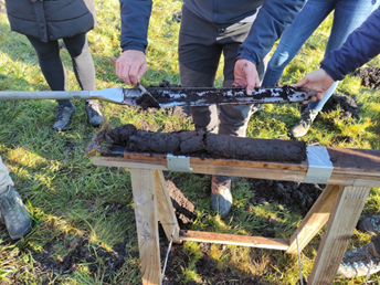
| 18:49, 14 May 2022 | 1.9.png (file) |  |
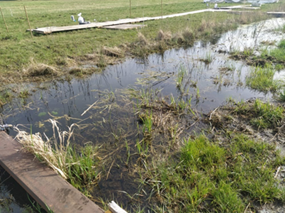
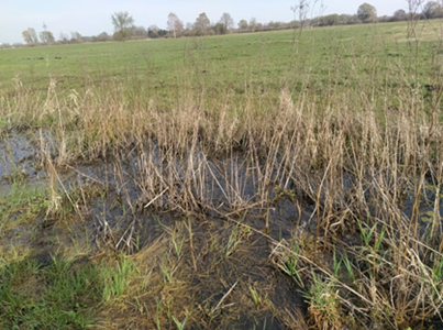
307 KB | peat deepth measurements | 1 |
| 18:48, 14 May 2022 | 1.8.png (file) |  |
275 KB | peat deepth measurement | 1 |
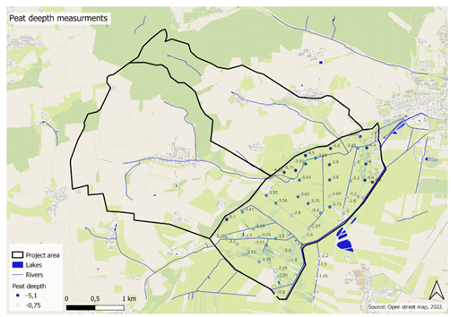
| 18:48, 14 May 2022 | 1.7 Peat depth.png (file) |  |
228 KB | Peat deepth measurements | 1 |
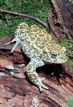
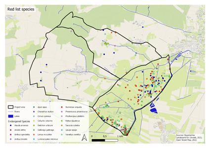
| 18:47, 14 May 2022 | 1.3 Red List Species.png (file) |  |
169 KB | Map of the Red List Species | 1 |
| 18:46, 14 May 2022 | 1.2. surface stream flows.png (file) |  |
356 KB | surface stream flows of subtributaries of River Moosach | 1 |
| 18:46, 14 May 2022 | 1.1 surface stream flows.png (file) |  |
334 KB | surface stream flows of subtributaries of River Moosach | 1 |
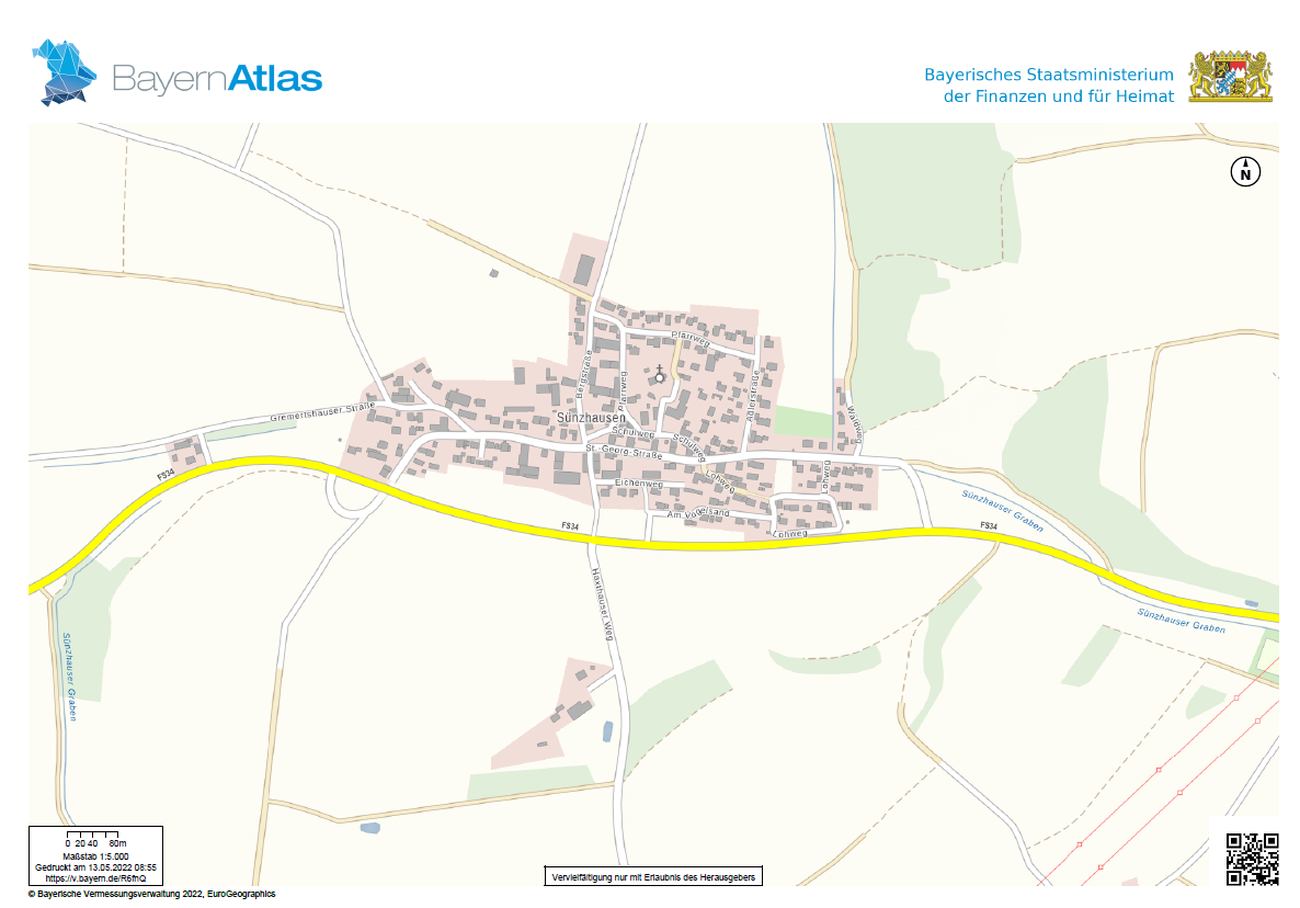
| 07:05, 13 May 2022 | Sünzhausen BayernAtlas.PNG (file) |  |
235 KB | 1 |